Photo spot 7: Kings Canyon National Park – Dusy Basin
2 Comments
Kings Canyon National Park features two easily accessible sites: a beautiful sequoia grove (Grant Grove) and the deepest canyon in the country (the Middle Fork of the Kings – about twice the depth of the Grand Canyon), however at least 95% of the park is backcountry with no road access. Since in the previous posts of the series, I’ve described locations relatively close to the road, for a change I will now describe a site that requires backpacking (although easy).
In my opinion, the most spectacular parts of the park are those near the Sierra crest. That’s where Ansel Adams took the images that convinced Franklin Roosevelt to approve Kings Canyon National Park – although FDR knew that he would never personally get to see those scenes himself. To this effect, Ansel sent a copy of his first book of landscapes, entitled “Sierra Nevada – The John Muir Trail” to secretary of the interior Harold Ickles. Ickles showed it to FDR, who promptly decided to keep it for himself. Kings Canyon National park was conceived by Ickles as a “wilderness park”, free from roads and large developments, and except for the two previously mentioned sites has remained largely that way.
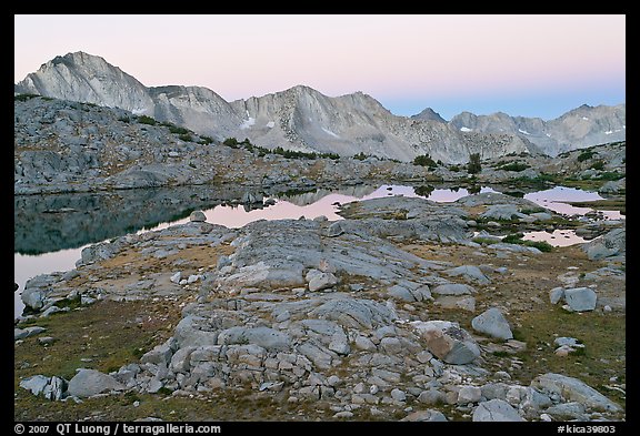
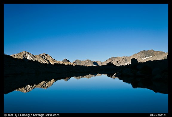
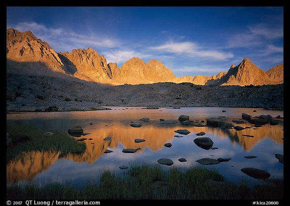
Dusy basin is one of my favorites high Sierra locations. A number of alpine lakes of various sizes, nested in a huge cirque mostly above tree line, reflect The Palissades, one of the most dramatic mountains in the Sierra.
The location is one of most accessible in the high Sierra. In fact, it could be visited on a long hiking day. Nevertheless, it is best to camp there for one or two nights, as the light would be better and the basin has much to explore. The view towards the Palissades is best at sunset. Being the highest mountain range east of the Pacific Ocean, the Sierra crest can catch remarkable alpenglows if the conditions are right. The Palissades are backlit in the morning, but do not neglect other views at sunrise.
Dusy Basin is free of snow from July to the first fall snowfall, which rarely occurs before late October. The stable summer weather of the Sierra makes it an easy backpacking destination. During my first trip there, my wife and I took only one sleeping bag between the two of us, and we did not carry a tent, as my 5×7 camera kit was already plenty of weight. My second trip was quite a different experience, as I traveled with Dayton Duncan, his son Will, and the Florentine film crew of “The National Parks, America’s Best Idea” all supported by a mule train and two cooks who prepared fresh food. You can hire Rainbow Pack Outfitters (which were great) for yourself too if you want to travel in style and comfort into the backcountry.
Free wilderness permits can be obtained at the ranger station in Bishop, or can be reserved in advance for $5 per person per day. From there, it is a 22 miles drive to the South Lake trailhead (9,800’). The basin is reached through Bishop Pass (11,960’, about 5.5 miles). Less than a mile after the pass, you’ll see a nice bivy spot under a tree, next to the trail. Wander cross-country left (east) of the trail from there to find a nearby attractive campsite next to the closest lake. With time, more lakes with different views can be found by hiking cross-country, or by following the trail that continues down to Le Conte Canyon.


View all images of Kings Canyon National Park


Fantastic series QT, I really enjoyed the all of them since I have camped up there a few times and slept on the top of Agasiz once. Nice view of Le Conte Canyon. Thanks for sparking some memories. My first hike up was difficult but now it’s a piece of cake!
Steve
PS. Thanks for taking that shot of me at the gallery show.
Great Pictures of Dusy Basin. Another amazing trip in the edge of Kings Canyon national park is the Miter basin. Featuring beautiful hidden lakes and featuring serene hidden vistas just south of the crowded mt. Whitney zone. Use the Army pass trail head from Lone Pine California, and it will be the trip of a lifetime!