Terra Galleria Photography

Pinnacles Moses Spring Waterfall at Least

For most of the year, Pinnacles National Park is quite a dry place. I revisited right after the high rains of this winter – which put to shame last year’s El Nino conditions, to observe the place transformed by the flow of the creeks and to photograph another elusive waterfall.

Pinnacles lies less than 50 miles from the Pacific Ocean, but the park is in the rain shadow of the Santa Lucia Mountains, resulting in a modest rainfall of 16 inches per year, mostly from January to March. The rest of the year sees frequent drought conditions, resulting in the hills being mostly covered by chaparral vegetation.

ISO 50, 24-70mm @26mm, 0.5s, f/16

To be sure that I would see the creeks flowing, I made a visit during the tail end of a period of rain. Although I had visited Pinnacles eight times since it became a national park in January 2013, this was the first time I saw the Chalone Creek flowing. To find a composition with a pleasant curve along the creek’s bank, I got my feet wet by crossing it. Using a polarizing filter, that I adjusted to maintain a balance between the silvery character of the creek and the color of its bed, let me slow the shutter speed just enough to smoothen the water. All the while, it was raining, which contributed to the atmosphere, but I just held my umbrella with my left hand, while controlling the camera on a tripod with my right hand.

ISO 200, 24-70mm @56mm, 15s, f/8

After Chalone Creek, I hiked Bear Gulch. Bear Creek was flowing nicely. It was the first time I saw the Moses Spring waterfall running that strongly, but it was getting quite dark. Since it was raining, I could not point the camera upwards to photograph its whole drop without getting the lens wet, and the water was not bright enough in comparison with the overcast sky. I made a distant photograph which failed to convey the height of the waterfall.

ISO 125, 24-70mm @65mm, 1/80s, f/8

My next visit was on a partly sunny Saturday, with the family. Because of timing and clouds at the wrong time, I had to content myself with a few hand-held photographs at Moses Spring, getting drenched in the process (to my wife’s disapproval) when an unexpected gust of wind shifted the waterfall towards me.

ISO 1000, 24-70mm @26mm, 1/60s, f/5.6

An easy-to-miss short spur from the main trail led to an unusually lush spot at the base of the waterfall. The hand-holding shutter speeds allowed me to capture the individual water drops and their impact in a small pool instead of longer streaks or mist that would have resulted from a slower shutter speed.

ISO 100, 16-35 @19mm, 15s, f/11

As the Bear Gulch caves were flooded and necessitated wading in knee-deep water, the photographic possibilities were intriguing, but nobody was in the mood for waiting. When I returned by myself on the next Monday, I was a bit disappointed that the waters had already receded to about ankle-deep, but it was still more than I’d seen in this location on previous years.

ISO 100, 24-70 @27mm, 0.3s, f/11
ISO 100, 24-70 @57mm, 1.6s, f/11

The flow level turned out to be excellent for photographing the waterfall that spills out from the reservoir into Upper Bear Gulch Cave. On Sunday, it had been more impressive, forming a solid sheet of water. However, I preferred the braids that appeared with Monday’s lower flow levels. Since it was a sunny day, I arrived there early to capture the scene in full shade before it would be partly illuminated by the morning sun.

ISO 50, 24-70 @53mm, 0.3s, f/22

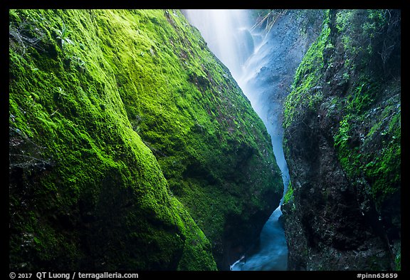
My main goal, however, was to photograph the Moses Spring waterfall. I came better prepared than on Saturday, wearing full rain gear, and even bringing my spinning rain deflector, but the waterfall was again just a trickle. However, the best light conditions would nevertheless maximize the contrast enought to make the scant water sparkle. This meant that the water would have to be directly backlit by the sun against a background rock wall in the shade. Having studied the location on previous visits, I was able to estimate the proper time window precisely enough to make the photograph within half-an-hour of arriving on site, at 11:30am. I tried a range of shutter speeds, and liked the effect of stopping down to the maximum – I avoided using a filter since I needed to minimize lens flare.

The light conditions that I used to capture Moses Spring reminded me of Horsetail fall minus the sunset, but although I was lucky to photograph the world-renown waterfall on my first try, it took more persistence to at least photograph the modest Moses Spring.

Yosemite’s Horsetail Fall Firefall at Last

In mid to late Feburary, Horsetail Fall on El Capitan is backlit by the setting sun, creating the unique natural phenomenon known as the “natural firefall”. Nowadays, the Yosemite firefall is widely known to the public, and even makes media headlines each year. The National Park Service has to close the inner lanes of the park loop road near the two viewing areas to provide parking for hundreds of viewers, whose cars line up the road for almost a mile. This year was the first time I photographed the Yosemite firefall. Why did it take me that long?

The Yosemite firefall was first photographed by Galen Rowell in 1973, and included in his seminal book Mountain Light (1986) that I read a few years later. During the first year I visited Yosemite, in 1993, I identified the location of Galen Rowell’s image and concluded that there was little room to make a different composition from there. I do not disdain iconic views, far from it! However, unlike wide vistas such as Tunnel View where varying light and weather allow for an almost infinite number of different images, the Yosemite firefall is in essence always the same. Despite all the accumulated knowledge, and the progress in camera technology, I noticed that hardly any of the thousands of images posted on the Internet improved on Galen Rowell’s, which when you think about it for a moment, is quite remarkable. Arriving in the morning to reserve a spot and standing shoulder-to-shoulder in a crowd of hundreds of photographers to repeat an image from someone else isn’t exactly my idea of nature photography.

In 2015, maybe because the crowding at the two viewing areas had reached a critical point, for the first time photographers found higher viewpoints which allowed to include Horsetail Fall in the context of Yosemite Valley. I was much inspired by the potential shown in images by Michael Frye and Shawn Reeder, but in the winter of 2016, I was way too busy trying to complete Treasured Lands to even think about a trip to Yosemite. This year, we had initially planned a family trip somewhere else during the school winter break of February, but when it was canceled due to unforeseen circumstances, I found myself with a few free days. I set my sights on the Yosemite firefall, on the last “good” day according to photographic wisdom, with the goal to create an image not seen before.

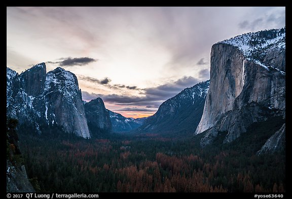
On Thursday, Feb 23, I hiked the Four-Mile Trail up to the point where it became washed-out by an avalanche. While the trail didn’t offer the views I was looking for, from it I spotted a promising location. After traversing precarious terrain (definitively not recommended, and remember that I am a more experienced mountaineer than most!) that included boulder fields, a steep gully and the partly frozen Sentinel Creek, I arrived at the base of a seasonal waterfall. I recognized it from a picture I saw a few days before, but due to the recent cold snap, a new crust of ice had formed, adding to the wintry impression. Since I knew that the waterfall flows only during wet years, I made sure to make it a main component of my composition. I liked the symmetry, that it echoed the distant Horsetail Fall, and that a sliver of wet rock, when photographed at the right angle, took on a specular quality, reflecting the sunset sky. I had started the hike under light snow flurries, hoping that clouds would allow a hole at sunset, but this did not happen. Apprehensive of coming back via the same hazardous terrain, I opted instead to go straight down directly in the forest, despite that being a new route to undertake in the dark. Although there was a bit of bushwacking, it turned out to be a much easier and safer route.

Friday morning was clear, but as the day progressed, the clouds built up to fill up most of the sky. Thinking that if nothing else, I’d get some exercise, at 4.30PM, I hiked up the steep 700 feet slope to the base of the cliff, passing on the way open views that included Cathedral Rocks with El Capitan on the right – a composition also available from the Four-Mile Trail. Due to warmer weather, chunks of ice were periodically falling down, making the base of the cliff quite a dangerous place to be – as is often the case of Yosemite cliffs. I kept an eye and ear upwards, ready to run away, and improvised some protection for my head. Next time, I will be sure to bring a sturdy mountaineering helmet! As I was beginning to think that a third attempt would be required, a shaft of light began to illuminate the base of Horsetail Fall. Within two minutes, a large part of the waterfall glowed, and less than two minutes later, the light was gone. It was a marginal show compared to some other days, when the light could last for more than ten minutes and the waterfall was illuminated from top to bottom. But to have witnessed that ephemeral and magical moment felt even more precious and lucky. Was the photograph worth the wait?

P.S. In case that wasn’t clear enough, this is a dangerous spot exposed to icefall, rockfall and avalanches that requires steep off-trail scrambling to access. Not recommended unless you are experienced in traveling wild mountain terrain!

Update Feb 24, 2019 from my friend Tommy: “Knee deep snow and ice all the way to the top. I was extremely careful when I reached the bottom of the fall. I surveyed the situation and concluded that the upper section was dangerously unstable. The upper section of the frozen waterfall did collapse when I was there, sending a river of large ice chunks down the cliff in a spectacular avalanche. It wouldn’t have been survivable even with a helmet, had I been directly in its path.”

Kenai Fjords National Park by Helicopter

In Alaska, because of the size of the land and the limited number of roads, much of backcountry access is by small plane. I have made aerial photographs in each of the Alaskan national parks. However, when planning an aerial session in Kenai Fjords National Park, it was exciting to notice that helicopter flights have become available there.

This is possible because Seward is a sizeable community by Alaska standards, and located a short distance from the national park. Kenai Fjords National Park packs such a diversity of scenery in a relatively small area that you could see a lot even on a half-hour aerial tour: mountains, glaciers, the fjords and lagoons, and icebergs. We extended our tour to one hour, which allowed us to reach places such as Pedersen Lagoon which has all of the above in single spot.

Compared to airplanes, helicopters have several advantages for aerial photography. The available range of speeds varies from hovering in a stationary position to speeds comparable to airplanes when you need to cover distances to get somewhere. They can fly at very low elevations, providing a stronger perspective since the foreground is much closer than the background. You could even land in many places, although not in the national park. The main drawback is that the charter cost, even with a relatively low-cost helicopter such as the popular Robinson R44, is still double that of a fixed-wing aircraft.

The Robinson R44 doesn’t have a sliding window, but our pilot, the excellent Mike Culver of Marathon Helicopters graciously agreed to remove the doors, a practice uncommon in Alaska! When you fly in a helicopter with doors removed, you have to make sure not to have anything loose in the cockpit, as turbulence could cause objects to get blown out the door and into the tail rotor. The tail rotor is the most fragile part of the helicopter and is critical to prevent uncontrolled spinning of the aircraft. I carried two cameras constantly strapped to me, one with a 16-35mm lens, the other with a 24-70mm lens, and kept spare batteries in my pockets.

Mike had told me that if I wished, I could lean out of the door to photograph, but when I tried to do so, the wind was unbelievably strong and I could barely hold the camera which was vibrating like crazy. For the rest of the flight, I made sure to not even stick the lens barrel out. Yet, with the doors removed, the back of the helicopter was still one of the windiest places I have ever experienced. Shutter speeds of at least 1/1000s were necessary to ensure photos were not blurred. Although I wore tops and bottom windbreaker fabric, I breathed a bit of relief when the flight ended and the wind stopped.

We had planned to take the flight in the early morning, but at that time the winds were too high. They would cause turbulences that make it unsafe to fly low. It was the only clear day of our trip, so we took off in the late morning. At that time of the day, even at those northern latitudes and in September, the sun was quite a bit higher than ideal, resulting in rather flat front light and side light. I mitigated the problem by shooting often slightly or entirely backlit, which increased the contrast and created a shimmering effect on the water. The window would have caused flare, so removing it was worth it!

Autumn in Alaska: Part 5 of 9: 1 | 2 | 3 | 4 | 5 | 6 | 7 | 8 | 9

Exit Glacier, Kenai Fjords National Park: Best Place Anywhere to Witness Glacial Retreat?

The combination of easy access, interpretive signage, and dramatic change makes Exit Glacier in Kenai Fjords National Park possibly the best place in the world to witness glacial retreat with your own eyes. This is an account of the changes I saw in my four visits to Exit Glacier from 2001 to 2016.

Exit Glacier is one of the most easily accessed glaciers in Alaska. After a 12-mile drive out of Seward, a pleasant city with plenty of amenities, you walk on a good trail to the edge of the glacier. The walk is getting longer as the glacier is retreating, but in 2016, it was only about a mile each way. The approach road and trail are punctuated with signs that indicate the position of the glacier terminus over the years.

Edge of the Glacier

After a 0.3-mile paved section, the trail splits. The well-maintained upper Edge of the Glacier Trail climbs the moraine, offering a view from above of a wall of blue ice fractured by crevasses and seracs. Because you are a bit higher, the perspective let you take the size of the glacier.

Exit Glacier, Edge of the Glacier Trail, 2000

I first visited Exit Glacier in 2000 when it was indeed possible to walk right to the edge of the ice.

Exit Glacier, Edge of the Glacier Trail, 2006

Returning in 2002, I looked for the spot where I had made the photograph in 2002, but noticed that the ice would have been too far to photograph the reflexion. In 2006, the glacier had retreated much further, but the terminus still ended on the plain, with a final slope that was gentle enough to make approaching the wall of ice safe.

Exit Glacier, Edge of the Glacier Trail, 2016, standing at the 2010 terminus point

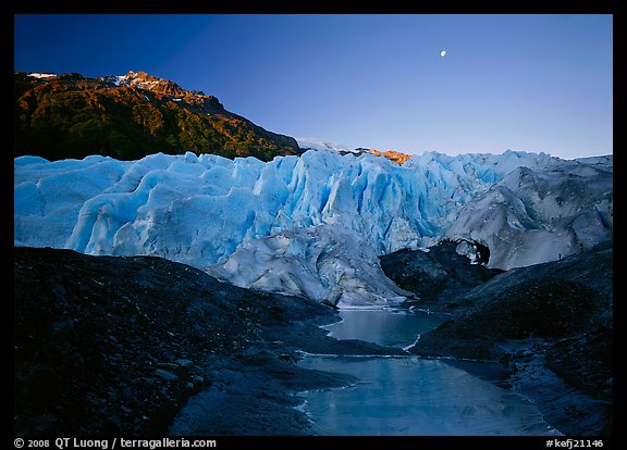
I last visited Exit Glacier in the fall of 2016. Although I was expecting to see changes, I couldn’t believe my eyes when I got to the end of the trail. It was enclosed by fence lines to prevent visitors from continuing further since the terrain beyond is a closed area, as it was too steep to be safe. Standing there, I was separated from the glacier by a distance of hundreds of yards. Yet a sign showed that the glacier reached this point in 2010. The glacial retreat had clearly been accelerating.

Exit Glacier terminus, Sept 10, 2016

In the late afternoon, Exit Glacier is in the shade, and under those conditions, the ice takes its characteristic blue tint. Water flowed out of the glacier from underneath an intriguing free-standing ice arch, and carried out icebergs. I immediately wanted to get closer.

Outwash plain from Edge of Glacier

Looking in the opposite direction revealed the deep gorge uncovered by Exit Glacier over the last decade, which nowadays is the only route that takes you closer.

Toe of the Glacier route

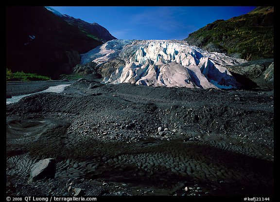
Exit Glacier, Toe of the Glacier route, 2000

The lower Toe of the Glacier route (not a set trail) crosses the rocky outwash plain of dark rock, which provides a striking contrast with the ice. During my previous visits, I was able to make my way to the terminus of the glacier to see it from below without getting my feet wet. The glacial stream meandered lazily on the glacial plain.

Exit Glacier, Toe of the Glacier route, 2016

In 2016, you had to go past the narrow gorge uncovered by glacial retreat. There is much less room in the gorge, and the stream is flowing right at the edge of the gorge’s wall. To come closer to the ice, I had to cross the glacial streams several times, the first one being right where the maintained trail exits the woods. As you can guess, the water was ice-cold. I was glad that I came well-prepared, wearing chest waders.

Exit Glacier, Toe of the Glacier route, 2016

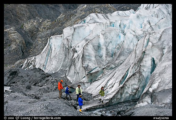
Moreover, the flow was much stronger. Even in knee-depth water, the force of the flow worried me. I definitively needed my hiking poles for the crossing. Even without listening to the stream’s roar, you can tell its power from the fact that it is now carrying icebergs, which I never saw in my visits of a decade ago.

Exit Glacier terminus, Sept 11, 2016

Since the terminus of the glacier is now much steeper than before, the danger posed by falling ice is considerably higher. If a block of ice was to detach itself further high, it could roll down quite a ways. Although there are no signs nor fences there, I stayed at a respectful distance from the terminus. It didn’t take long for the glacier to change. The free standing arch that intrigued me the day before had already collapsed the next day!

Autumn in Alaska: Part 4 of 9: 1 | 2 | 3 | 4 | 5 | 6 | 7 | 8 | 9

A day on and under the ice, Wrangell-St Elias National Park

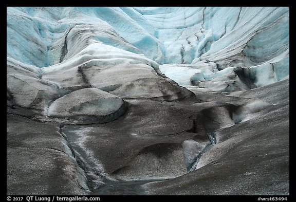
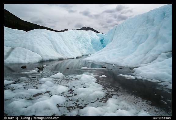
Although Wrangell-St Elias is a national park of immense size – the largest of all with immense potential for exploration, perhaps none of the experiences it offers is as accessible and remarkable as exploring its Root Glacier. Find out what I discovered by spending a day wandering above and also under the ice.

Of all U.S. national parks, Wrangell-St Elias provides arguably the easiest access to a glacier and the most interesting glacier to explore. You need a long hike to reach the glaciers in the continental U.S. There are only three Alaskan national parks with roads, Denali, Wrangell-St Elias, and Kenai Fjords. The Alaska Range and its glaciers are very far from the Denali park road. The terminus of Exit Glacier in Kenai Fjords National Park is quite close to the trailhead, but it is too steep to be explored safely, and therefore you need to hike up a trail with 1,500 feet elevation gain before approaching the glacier. By contrast, the hike from the historic mining town of Kennecott to the point where you enter the Root Glacier is less than two miles on the mostly flat and well-maintained Root Glacier Trail.

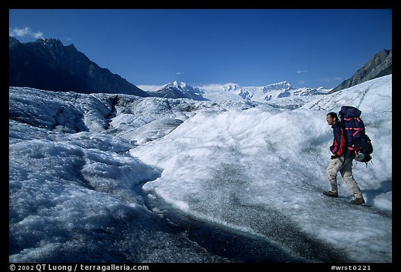
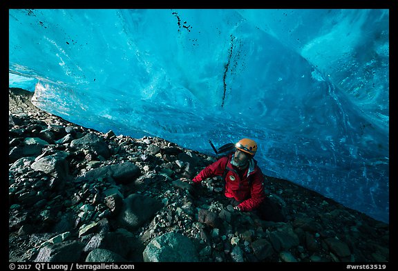
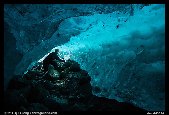
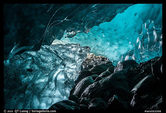
In 2000, I crossed the entire width of the Root Glacier on my way to Mt Donoho. I was carrying a big backpack (above) that included my camping gear and 5×7 camera system. This limited my agility on the glacier. Last fall, I returned to Kennecott to explore the glacier more thoroughly, and in particular to visit its glacier caves. Glacier caves, often called ice caves, are caves formed within the ice of a glacier, often by water flowing underneath the glacier. Iceland has probably the best ice caves in the world. At lower latitudes, they are often unstable, like the Mt Rainier Paradise ice caves which are now mostly collapsed. By contrast, Alaska’s latitude is northern enough to offer stable ice caves even at lower elevations.

After several days in the Nabesna Area, I had just one day left to spend in Wrangell-S Elias National Park. There was no flexibility because the next day was going to be the only day of our trip without rain, and we had made arrangements for an aerial photo shoot in Kenai Fjords. With little time to poke around randomly, I thought it would be more effective to go with a local guide who would know where the ice caves are located. St Elias Alpine Guides offers a $95 ice cave trip, but their website mentioned “glacier hike required prior to booking”. Since I am a government-certified hiking guide and a technical mountaineer with some documented accomplishment, I was disappointed that they would not waive that requirement, which I found a bit questionable, since the skills needed for the ice cave exploration are different from those needed for hiking on a glacier. It turned out that you didn’t even need to wear crampons to access the ice caves, but at that time I didn’t know that, and I hadn’t packed them for this trip, hoping that some of the Kennecott outfitters would rent them – they do not for liability reasons. Since I was traveling with a friend, we ended up hiring a guide (Chris, who was excellent) for a full day private trip, at a cost of $275/person, the first time I did so in the mountains since my formative days.

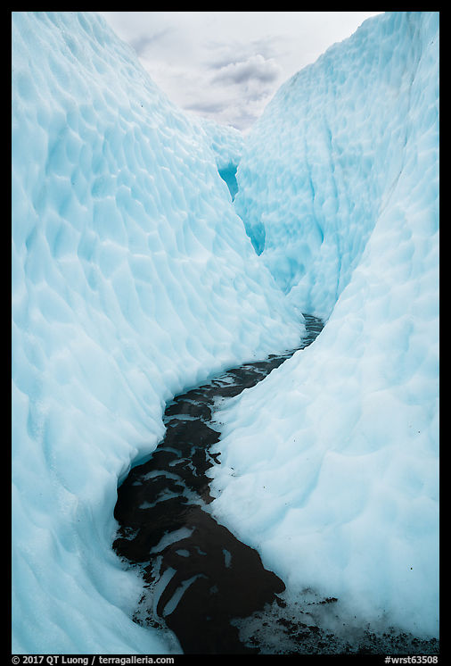
It was worth it. During my previous visit, I had spent a whole day on the glacier, and an additional half-day on the day back. Yet, I saw some nook and crannies of the glacier that I had missed. Besides waterfalls and moulins – holes drilled at cavernous depths into the glacier by flowing meltwater, the highlight was to walk into a crevasse carved via meltwater from the bottom, an experience which reminded me of a slot canyon. Besides the fact that you are wearing crampons, the glacier hike is not more difficult than a normal hike, and you get to explore an otherworldly environment that you would not expect from looking at the glacier from a distance.

The ice caves are not located on the glacier, but rather at its edge, and the most reliable ones have been carved by Jumbo Creek, as it flows below the glacier. Jumbo Creek is the only significant creek crossed by the trail, at about 1.4 miles from the trailhead. From there, a scramble down a steep and loose user trail leads to the edge of the glacier where the ice caves are situated.

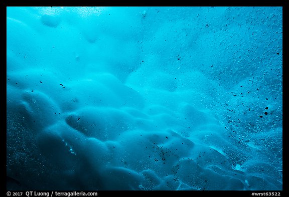
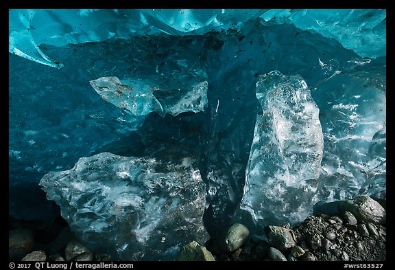
Raingear is needed, as there are sections of the cave with dripping water, and so are helmets, since rocks can fall from the surface of the glacier as you enter the cave. Once inside, the floor is quite muddy, and low ceilings require some contortions and crawling, but there is nothing that is beyond the ability of a fit hiker. The reward is experiencing that mystic blue glow passing through the translucent walls of ice, as well as the variety of textures and patterns of the walls themselves. If you are going to photograph, due to dim light levels, don’t skip your the tripod, although it is quite awkward to deploy, and an environment quite hostile to cameras!

Autumn in Alaska: Part 3 of 9: 1 | 2 | 3 | 4 | 5 | 6 | 7 | 8 | 9

The Road Less Traveled: Nabesna Road and Skookum Volcano, Wrangell-St Elias National Park

Besides the incredibly raw ghost mining town, the Nabesna road in Wrangell-St Elias also provides access to the more expected experience of a national park: a beautiful scenic drive that leads to several trailheads for great hikes, with a campground and lodges available. But unlike on other park roads, you won’t have to share with experience with a crowd.

The road

There are only four roads in Alaska’s national parks. The three others are the Denali road which is mostly restricted to park busses, the short Exit Glacier access in Kenai Fjords, and the Mc Carthy road traveled by the vast majority of visitors to Wrangell-St Elias. So being able to drive deep into an Alaska national park is a big deal. The Nabesna Road begins at mile 60 of the Glenn Highway (Tok Cutoff), in the town of Slana. No gas is found in Slana nor along the Nabesna Road. It ends at the unincorporated community of Nabesna which, comprises a few homes, the Devil’s Mountain lodge, and an airstrip. It takes about 1h30 to drive the 42 miles one-way.

The mostly unpaved road is well-graded, but three stream crossings might require high-clearance vehicles or become impassable after rains. Many travelers turn back at Mile 29, the first of the stream crossings, because they don’t want to risk getting stuck on the far side, should the weather turn to rain. Most of the traffic is from locals and hunters. On both my visits, I didn’t see more than half a dozen other vehicles each day there.

Along the road

For the first 25 miles, the road passes through lowlands where thickets lining up the shoulder often obscure views of the distant mountains. However, of interest at closer range, moose and caribou browse the wetlands and lakes. The Wrangell range comprises some of the most voluminous volcanoes in the world. The best views of those peaks to the south are between Mile 15 and Mile 18. From there, they are quite distant and require a telephoto lens.

Lakes of various sizes abound along the road. Around mile 17, there is a large pull-out on the north of the road, overlooking an unnamed lake. From the pull-out, the lake is obstructed, but by strolling down a short distance, I found a fine view. Around mile 21.5, I photographed Rock Lake right from the road.

Skookum Volcano

For a day hike starting from the Nabesna road, I picked the Skookum Volcano Trail, possibly the most rewarding and unique of the several hikes accessed from the road. By contrast to the soaring Wrangell mountains, substantial erosion has reduced Skookum Creek Volcano (7,125 feet), an old shield volcano, to a modest size, but also revealed fantastic shapes and colors unexpected in this landscape.

The trailhead is at mile 36.2, and after a section in the forest and along a stream, the terrain changes to high and open tundra. The trail ends at a high pass (1,800-foot elevation gain, 2.5 miles one-way) which was frequented by Dall sheep and offered great views on both sides. The low cloud ceiling obscured the weird mountains, but I was glad that it didn’t rain. If we hadn’t changed our itinerary upon landing in Anchorage, we would have been soaked in Kenai Fjords!

Instead of retracing my steps, I descended into the unknown on the other side of the pass to complete a loop (8 miles) on trail-less terrain which consisted of tundra followed by a rocky streambed which made route-finding easy. At the transition between the two, a steep ravine required a bit of tricky climbing on crumbling rock.

Where to stay

Kendesnii Campground, the only developed National Park Service (NPS) campground in the park, is located at mile 27.8. By the way, don’t let “developed” raise your expectations too much: here it just means that there are picnic tables, fire rings, and two vault toilets. However, the location, next to a lake, is quite scenic. I made the photograph below while walking on the campground loop road.

You can also camp primitively at several other waysides along the road. The public use Viking Lodge Cabin (mile 21.8) may be reserved at the Copper Center Visitor Center. There are two private lodges along the road, the Sportman’s Paradise Lodge at mile 28.5, and the Devil’s Mountain Lodge at mile 42. The later also doubles as an outfitter and air service.

More images from Wrangell-St Elias National Park

Autumn in Alaska: Part 2 of 9: 1 | 2 | 3 | 4 | 5 | 6 | 7 | 8 | 9

Stumbling into Alaska’s mining past in Nabesna, Wrangell-St Elias National Park

For something a bit different within our national parks, I visited the incredibly raw and well-preserved mining ghost town of Nabesna, a rare and off-limits find in the quiet northern corner of Wrangell-St Elias

Of the two roads that lead into Wrangell-St Elias National Park, Nabesna Road, which opens up the northern reaches of the park, is much less visited than McCarthy Road. It is situated in a more remote area and lacks the two big draws of Kennecott, the impressive mining buildings, and glaciers.

That the national parks preserve some of the most beautiful scenery in the nation make it easy to forget that they also feature many sites where one can learn about the nation’s history. Although I am drawn to the natural beauty, I am also intrigued by the lives of those who came there before. Often, the more remote the land, the best preserved and the artifacts. I had high hopes for the mines and ghost towns of Nabesna. The discoveries I made didn’t disappoint, and each of the three sites I visited offered something different.


The Rambler Mine

While the Nabesna Road is well graded, past the Devil’s Mountain Lodge it is no longer maintained, and it looked like a high-clearance 4WD vehicle would be necessary to traverse the deep ruts. I parked our car about 1/4 mile beyond the lodge, at a small gravel parking area. After 1/4 mile along the road, a uphill 1/2 mile tree-canopied trail leads to the Rambler Mine. We had initially planned to hike the Skookum Volcano, but in view of the weather, we were glad that we had changed our plans to visiting the mines. The abandoned buildings there have been stripped bare, but they provided a welcome shelter from the rain, and although the mines have been gated and locked by the NPS, we could peer into their openings to see wagons and rails.

As I noticed the rain easing off a bit, I led our group up a steep and rather unstable trail along a chute. We reached not only to another mine opening but also views over the Nabesna River Valley that were open, unlike those from the mine which were obscured by vegetation. All of the sudden a double rainbow appeared. It was such a transcendent moment because it had been raining most of the day so far. If you want to see a rainbow, you have to get out in the rain!


The Nabesna Mill

Back to the main road, after 1.5 miles from the Rambler Mine trail junction, a side road covered with toxic-looking tailings led to the main Nabesna mine mill. The rather large building is still full of machinery and hardware. The Kennecott mine has more big and impressive mill buildings, but the mill buildings in Nabesna are way more raw. In Kennecott, you get to see one of the best preserved ghost towns in America, yet the ruins are being partly restored and stabilized, and the buildings can be entered only on guided tours. By contrast you can wander around everywhere in Nabesna, make your own discoveries as if you were the first visitor happening into a lost world, and besides the removal of some heavy equipment, you can see what the mines looked like when they were closed. I avoided the second floors, though, as they did not look too stable.

While the Kennecott mine was a copper mine, gold was discovered in Nabesna near the end of the 19th century, and the Nabesna Mining Company was formed in 1929 by Carl Whitham. The present-day Nabesna road was built to provide access to the mining camp. During the Great Depression, some men walked more than 100 miles from the Richardson Highway just to ask for a job there. With more than 1/4 ounce of gold per ton – more than current active mines, the Nabesna mine was doing great, but in 1942 all the gold mines were closed to shift miners to copper and iron mines that supported directly the war effort. Whitham made plans to reopen the mine after the war, but they were scrapped after he died in 1947.


The Nabesna mining cabins

Back to the main road, after 1/4 mile, we saw on our right a group of cabins with busted doors that from the outside looked exactly like many others in the area. However, upon entering them, I was astonished by the amount of stuff scattered in there. Some of it appeared fairly recent, but there were plenty of historic artifacts related to mining, such as ore samples and mining documents, some of which dated from 1935. For a moment, I felt like I had gone back in time. The setting was the most undisturbed, artifact-rich ghost town that I’ve been privileged to explore.

Getting there

There is little published information about the Nabesna mines. They are not mentioned in any guidebooks. My main source was a blog post written in 2014 by photographer Adam Eliott. On the way, I also inquired at the Devil’s Mountain Lodge where a member of the Ellis family, who had been operating the lodge for three generations, kindly showed me a helpful map. The Devil’s Mountain Lodge is at the end of the 42-mile maintained portion of the Nabesna Road.

If you visit the area, exercise caution as structures are potentially unsafe, and be sure to leave everything as you found it so that future visitors can experience the same discoveries that you did. Note also that while the Rambler mine now belongs to the park, the Nabesna mine are still technically private property, and for this reason the NPS doesn’t encourage visitation. This makes the visit akin to “urbex”, urban exploration of abandoned buildings. Are you comfortable with that ?

More images from Wrangell-St Elias National Park

Autumn in Alaska: Part 1 of 9: 1 | 2 | 3 | 4 | 5 | 6 | 7 | 8 | 9
Best Photobooks 2016: the Meta-List

Here is this year’s meta-list of best photobooks. It started with the Aperture Photobook Awards 2016 shortlist, and continued with Olga’s compilation of lists at phot(O)lia, which I encourage you to visit to follow the links to those lists.

The methodology is the same as for my meta-lists of previous years (2012, 2013, 2014, 2015), except that this year, I have counted the 25 individual 3-item lists from Photo-Eye. The total number of lists was 75.

(19 votes)
Zxyzx GREGORY HALPERN Mack

(15 votes)
Discordia MOISES SAMAN Self-published

(14 votes)
Astres Noirs KATRIN KOENNING & SARKER PROTICK Chose Commune

(12 votes)
Sugar Paper Theories JACK LATHAM Here Press

(11 votes)
Libyan Sugar MICHAEL CHRISTOPHER BROWN Twin Palms

(10 votes)
Wolfgang DAVID FATHI Skinnerboox
Provoke: Between Protest and Performance DIANE DUFOUR & MATTHEW WITKOVSKY (Eds) Steidl

(9 votes)
Shenasnameh AMAK MAHMOODIAN RRB Publishing

(7 votes)
In the beginning DIANE ARBUS Metropolitan Museum of Art

(6 votes)
Black Is the Day, Black Is the Night AMY ELKINS Self-published
Golden Days Before they End KLAUS PICHLER Patrick Frey
Negative Publicity: Artefacts Of Extraordinary Rendition EDMUND CLARK & CROFTON BLACK (Eds) Aperture
Snowflakes Dog Man HAJIME KIMURA Self-published

(5 votes)
Anaesthesia VALENTINA ABENAVOLI Akina
End EAMONN DOYLE D1
Tokyo GERRY JOHANSSON Only photography

(4 votes)
1% privilege in a time of global inequity MYLES LITTLE (Ed) Hatje Cantz
Border Cantos RICHARD MISRACH & GUILLERMO GALINDO Aperture
Folklig Idrott MAXIMILIAN STEJSKAL Patrick Frey
Fuck it MICHELE SIBILONI Patrick Frey
Got to Go ROSALIND FOX SOLOMON Mack
Impasse Hotel Syria KRASS CLEMENT Glydendal
In flagrante two CHRIS KILLIP Steidl
Little North Road DANIEL TRAUB Kehrer Verlag
Matter / Burn Out DAISUKE YOKOTA Artbeat
New York in Photobooks HORACIO FERNANDEZ (Ed) RM
Shadows of Wormwood ARTHUR BONDAR Self-published
The House of Seven Women TITO MOURAZ Dewi Lewis

(3 votes)
(Un)expected PETER DEKENS The Eriskay Connection
Aeronautics in the Backyard XIAO XIAO XU The Eriskay Connection
Anthony Hernandez ANTHONY HERNANDEZ SFMOMA
Come to Selfhood JOSHUA RASHAAD MCFADDEN Ceiba
Contains 3 books JASON FULFORD The Soon Institute
Estamos Buscando PAUL TUROUNET Self Published
Every night temo ser la dinner SOFÍA AYARZAGOITIA La frabrica
Fifteen Miles to K-Ville MARK STEINMETZ stanley/barker
Folk AARON SCHUMAN NB
Foreigner DANIEL CASTRO GARCIA & THOMAS SAXBY Self-pubished
Hometowns JOHN MACLEAN Self-published
Kitchen Table Series CARRIE MAE WEEMS Damiani
Lost Coast CURRAN HATLEBERG TBWBooks
Portraits WILLIAM EGGLESTON Yale University
Radicalia PIERO MARTINELLO Self-published
Santa Barbara Return Jobs to the US. ALEJANDRO CARTAGENA Skinnerboox
Summer Days Staten Island CHRISTINE OSINSKI Damiani
The Difficulties of Nonsense ROBERT CUMMING Aperture
The Epic Love Story of a Warrior PETER PUKLUS SPBH
The Jungle Book YANN GROSS Aperture
The Meadow BARBARA BOSWORTH & MARGOT ANNE KELLEY Radius
The Narcissistic City TAKASHI HOMMA Mack
The Prospect of Immortality MURRAY BALLARD Gost
Tulips ANDREW MIKSYS ARÖK
Where We’ve Been, Where We’re Going, Why? DAN BOARDMAN & ASPEN MAYS Houseboat Press/Conveyor Editions

(2 votes)
A House Without a Roof ADAM GOLFER Brooklyn
A Topical Times for these Times KEN GRANT Rrb publishing
All That Life Can Afford MATT STUART self-published
Another Girl Another Planet VALERIE PHILLIPS Rizzoli
Badly Repaired Cars RONNI CAMPANA Hoxton Mini Press
Bar Espagnol PABLO CASINO self-published
Barespagnol PABLO CASINO Dalpine
Cosmic Surgery ALMA HASER Self-published
Cucurrucucú CRISTINA DE MIDDEL Editorial RM
Dear Clark; Portrait of a Con Man SARA-LENA MAIERHOFER Drittel Books
Early Times VASANTHA YOGANANTHAN Chose Commune
Essential Elements EDWARD BURTYNSKY Thames & Hudson
Factory Andy Warhol STEPHEN SHORE Phaidon
Girl plays with snake CLAIRE STRAND Mack
Goodbye America BRAD FEUERHELM Yard Press
Highway Kind JUSTINE KURLAND Aperture
Home Around the World ELLIOTT ERWITT Aperture
Home Instruction Manual JAN MCCULLOUGH Verlag Kettler
Homes HARLEY WEIR Loose Joints
How We End HANNAH SCHNEIDER & KATE STONE Self-published
Invisible Man GORDON PARKS Steidl
Kids in Love OLIVIA BEE Aperture
Known and Strange Things TEJU COLE Penguin Random House
Lobismuller LAIA ABRIL Editorial RM/Images Vevey
Looking For Alice SIAN DAVEY Trolley Books
Making Memories LUCAS BLALOCK SPBH
Matter MICHAEL LUNDGREN Radius Books
Mexico: Photographs MARK COHEN University of Texas
My Air Force VOJTĚCH VEŠKRNA Self-published
North Point HIROYASU NAKAI Roshin Books
OSC (Osaka Station City) ANTONY CAIRNS Self-published
Out of the Blue VIRGINIE REBETEZ by Meta/Books
Photographs ELLSWORTH KELLY Aperture
Picture Of My Life JUNPEI UEDA Self-published
Political Theatre MARK PETERSON Steidl
Poste Restante CHRISTER STRÖMHOLM Strömholm Estate (reprint)
Power to the People: The World of the Black Panthers STEPHEN SHAMES & BOBBY SEALE Abrams
Provisional arrangement MARTIN KOLLAR Mack
Raised by Wolves, the bootleg JIM GOLDBERG Self-published
Recruit HIROSHI OKAMOTO Self-published
Revoir JH ENGSTRÖM Journal/Akio Nagasawa
Saints PANOS KEFALOS Fabrica
Sentimental Journey NOBUYOSHI ARAKI Kawade Shobo Shinsha (reprint)
Shinjuku Lost Child SEUNG WOO YANG Zen Foto
So Long China PATRICK ZACHMANN Xavier Barral
Stills KATRIEN DE BLAUWER IIKKI
Stray PAUL GAFFNEY Self-published
Tear Sheets Publisher PACIFICO SILANO Silent Face; Dashwood Books
Tenko HANAYO & HAJIME SAWATARI Case
Thatcher’s Funeral JAMES O’JENKINS Self-published
The Castle FEDERICO CLAVARINO Dalpine
The Democratic Forest WILLIAM EGGLESTON Steidl
The Modern Spirit is Vivisective FRANCESCA CATASTINI Anzenberger
The last son JIM GOLDBERG. Super Labo
Transparency is the new mystery MAYUMI HOSOKURA Mack
Valparaiso SERGIO LARRAIN Xavier Barral
While leaves are falling TAKAHIRO KANEYAMA Akaaka Publishing

Treasured Lands acclaimed by The New York Times and High Country News

I am honored that last December, Treasured Lands received superlative reviews from two diverse print publications, both of them ranking the book at the top of the National Park Service Centennial publications.

The New York Times Book Review

The New York Times has published a Sunday book review section since 1896, maybe the most influential in the U.S. The holiday 2016 edition includes the book round-up Great Outdoors: Landscapes, Both Natural and Created by Human Hands, by the influential writer and editor Dominique Browning. It opens with a review of Treasured Lands.

“The centennial of the National Park Service has been the occasion of […] many books. The most glorious of these is TREASURED LANDS . . . No one has captured the vast beauty of America’s landscape as comprehensively.”

High Country News

High Country News is the independent news organization for people who care about the American West’s environment and communities. The last issue of 2016 includes An inside look at the national parks, the most detailed review of Treasured Lands to date.

“Treasured Lands is the single-most monumental literary achievement during a year that brimmed with words and pictures dedicated to the centennial of the National Park Service . . . To be sure, it is a visual feast. But it’s much more than that, because of its geographic completeness and the attention to detail that only someone who has lived and breathed the parks for a long time could provide . . . Luong’s work stands out on the crowded shelves of national park tomes because of the generosity not just of his vision but of his accumulated wisdom.”

More reviews excerpts confirming that Treasured Lands is the photography book of the U.S. National Parks can be seen here, and the sentiment is also echoed by several Amazon customers.

Seasons Greetings

Wishing you Happy Holidays, or Merry Christmas, and a great time with family and friends, full of peace, love and joy.

May your year 2017 will be filled with health, success, and creativity!