Terra Galleria Photography

Book review: A Sense of Yosemite

Yosemite, one the most popular and oldest national parks, has inspired photographers from its creation. Carleton Watkins and Ansel Adams created some of their most important work in the park. More recently, photographers as different as Galen Rowell, William Neill and Michael Frye left their distinctive visual mark there. Having studied many photography books about Yosemite and even authored one (Spectacular Yosemite), I feel well qualified to assess a book’s unique contribution to the visual Yosemite litterature, so I was pleased to receive for review A Sense of Yosemite. The book is the latest production from the Yosemite Conservancy, an association that does a great job at helping preserve Yosemite, and has brought us many fine books about the park over the years.

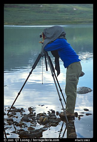
Although it is a big challenge in a park with a such a long photographic history, Nancy Robbins, the photographer for the book, has managed to find plenty of new takes on familiar scenes. In “Redbud at Tunnel View” an unexpected patch of pink adds an element of surprise to the iconic scene. Likewise, in “A View of Nevada Falls”, a foreground of summer flowers provides an original touch to another classical view. Since she began to photograph extensively Yosemite after moving there in 2004, I assume the book was photographed with digital cameras. Their dynamic range enabled images such as the splendid “Yosemite Falls and Half-Dome” whereas their sensitivity – and the ease to make composite images opened the door to night photographs such as “Star Trails above Bridalveil Falls” and “Horsetail Fall, afterglow”. The photographer’s proximity to the park made it possible for her to capture elusive seasonal spectacles such as a rare cluster of twenty four snow plants (one would be lucky to see just a few!) or frazil ice flowing down Lower Yosemite Falls, a phenomenon that was mostly overlooked until a Yosemite Conservancy video brought it to wide attention. When the Meadow Fire broke, she was there on the first evening for a striking photograph, whereas I arrived on the second evening, when the fire’s intensity had been greatly reduced thanks to the firefighters efforts.

Its deservedly famous views of cliffs and waterfalls are among the most spectacular in the world, but Yosemite Valley’s vistas represents only a small fraction of the beauty the park has to offer. A Sense of Yosemite does a good job of giving a survey of the park, including at least an image of each major sight, and although the high country (which represents 95% of the park) isn’t very well represented, its most prominent locations and accessible locations are there too. On the other hand, Robbins shines in capturing the whole range of nature scenes, from spectacular light and atmospheric conditons (fog!) on the grand landscape, to the more intimate details which may be a natural outlet for her experience as a portrait photographer well acquainted with the place. “winter’s chill” superimposes patterns of frozen ice and fallen leaves to combine two seasons. A section of the book showcases the passing of the seasons, and at first I thought that the heading “Finter” was a typo. Upon reading the captions, I understood that Robbins was referring to the brief collision of Fall and Winter at the same time. Unlike in other landscape books (think Ansel Adams and his followers), wildlife makes a frequent appearance, and the animal portraits contribute to the overall joyfull tone. The image sequences of a coyote catching a prey in winter, and of “Twenty Minutes in the Life of a Ladybug” showcase it in a playful and cinematic way.

The choice of images, themes (which even include a “black and white” section), and sequencing in A Sense of Yosemite give a kaleidoscopic representation of Yosemite as a sum of many parts and viewpoints. The park appears as a collection of glimpses. The texts that accompany the images reinforce that impression. Robbins’ words consists of captions that mostly emphasize her own experience of the place as a photographer. The essays by David Mas Masumoto, as somehow expected from a farmer, are down to earth. They are each one page or less, and rather than focussing on natural history or conservation as is often the case, elaborate in a personal way on our relationship with the park via multiple approaches. Both form an accessible and rewarding dialog. After an essay by Mas Masumoto entitled “The Nature we hear”, a great spread contrasts Fern Springs – shot with a low viewpoint that emphasizes its waterfall-like appearance, with Upper Yosemite Fall from Fern Ledge, and in the captions Robbins evokes the “sweetest babble” of the former and the “thunderous” sound of the later. Overall, this beautiful coffee-table book lives up to its promise of giving us a “sense of Yosemite”.

Exploring the Channel Islands Sea Caves by Kayak

On the eve of my highest profile presentation to date, an improvised quick trip to Santa Cruz Island leads to beautiful discoveries and a new perspective on Channel Islands National Park.

Last Monday, after picking up the kids at 2:30pm, I found that my preparation for the multiple presentations to be given in Santa Barbara on Wednesday was essentially completed. I decided to use the extra day for a quick trip to the Channel Islands, since the Channel Islands Harbor in Ventura is just half-an-hour from Santa Barbara. With little time left, I looked on the internet for fifteen minutes before booking a trip with an outfitter, Santa Barbara Adventure Company for the next day. The cost of $179 is very reasonable considering that it includes Island Packers ferry transportation, use of the kayaks and services of a guide. I received a gear list by email and packed everything in one hour (including 50 copies of Treasured Lands), then drove five hours from San Jose to Ventura. The next morning, I noticed near the Island Packers office another outfitter even offering walk-in kayak tours. Embarking on a national parks adventure doesn’t necessarily require much advance planning!

Of all the islands, Santa Cruz is the best choice for a day trip. Because Anacapa is so small, the trips there are set up in a way that doesn’t leave much time on the island. The three other islands are just too far for a day trip. I had explored hiking trails on Santa Cruz island on a previous trip. On two occasions, on the return from an outer island, the Island Packers boat visited Painted Cave, one of the largest sea caves in the world. It was impressive to see the large vessel entering the sea cave, but the experience left me yearning for a more intimate exploration. I had read that one of the most remarkable features of the cost of Santa Cruz Island is the concentration of beautiful sea caves.

Having previously experienced calm waters on autumn scuba diving trips to the Channel Islands, I was surprised by the strong wind and swell on Tuesday. For the first time in several decades, I even got seasick towards the end of the crossing to Santa Cruz Island, which made for a rattling start to the day. The authorized outfitters have each a spot on the beach of Scorpion Anchorage where they store kayaks and gear, making the logistics simple. Santa Barbara Adventure Company provided everything which was needed, even some of the items on the packing list, such as water shoes, eyeglass straps, gloves, and sunscreen, so in fact you didn’t need to bring anything particular rather than a bathing suit to wear under their wetsuits, a water bottle, and a snack.

It was a beautiful day, quite balmy for November, but paddling upwind was tough, especially with the sit-on-top kayak not feeling very stable in the swell compared to the sit-inside kayaks I am used to. The possibility of flipping over at times didn’t seem so remote. We spent about four hours on the water, and paddled maybe a total of 2.5 miles, both to west and to the east of Scorpion Anchorage, where we launched the kayaks.

Within this distance, we visited four different sea caves. Most of them form a tunnel, which means that you enter via one end, and exit via a different end, which makes for a fun exploration. Sometimes, the tunnel was barely wide enough for a kayak.

Besides making paddling quite strenuous, the swell also preventing us from exploring a few sea caves, where the water was too turbulent. One of the caves we visited has normally exquisitely blue water, but that day, the color was hidden by whitewater! The swell made the photography challenging on two counts. First, I often had to keep the camera in the dry bag that I kept between my legs to prevent damage from water splashes. In retrospect, given the rough water conditions, I should have used a waterproof enclosure rather than a dry bag. Second, the kayak was often rocking, which required me to use a faster shutter speed, which combined with the dim light in the caves often resulted in a high ISO. And while snapping the pictures, I had to be careful not to hit rocks too hard!

An advantage of the mid-week, November trip is that the group was small. It was just two Canadians, our excellent guide Kyle, and me. Towards the end, I got quite tired and was glad to be standing on firm terrain again. However, it was a great experience that opened my eye to new possibilities. I had stood on top of the same cliffs, but did not suspect the beauty which could be seen by entering them from water level, a short distance below. I am already planning to come back earlier in the season, in August or September, when conditions are often more calm, traveling with friends or family for more flexibility.

On Wednesday, I delivered three different presentations about “Treasured Lands”. The first one took place at the Carpinteria High School, which serves a semi-rural community with a large Hispanic population.

Since I had been warned that the kids there can be quite rowdy, I was pleased to be able to hold their attention and try to inspire them to visit a national park. They are the future generation for which the parks are preserved, and the constituency that our parks will need as advocates in the future.

(photo by Cathy Oliverson)

Since I did not go to art school, nor did I receive any formal training as a photographer, I was honored to present and answer questions at the UCSB College of Creative Studies in the afternoon.

It was cool (and humbling) to see the announcement for my evening presentation next to Joan Baez in the UCSB Arts and Lectures season catalog. It was part of a lecture series celebrating the National Park Service Centennial and the other speakers were Ken Burns, Dayton Duncan, Douglas Brinkley, and Terry Tempest Williams.

Maybe due to the competition from the World Series Final, Campbell Hall was only half-filled despite press announcements but since the auditorium, largest on the UCSB campus, seats 800+, that was still a great turnout for me. I found it rewarding that the 40+ people who came on stage to have their copy of Treasured Lands signed afterwards said they enjoyed the presentation greatly.

(photo by Roman Baratiak)

I will be making arrangements for more events in 2017. If you have suggestions for venues, they would be most welcome!

Event on Wednesday at UCSB

If you live near Santa Barbara, CA, check out my national parks presentation at Campbell Hall, University of California at Santa Barbara, on Wednesday, November 2, 7:30pm part of UCSB Arts and Lectures. Here are announcements from Santa Barbara Independent and Ventura County Star.

Also, I will hold a more intimate session, more focused on the creative aspects of the project, with USCB College of Creative Studies in the afternoon. Details here. I’ll spare you details of the school visit, although I am always excited to share with the younger generation!

Naturally, I’ll have a quick trip to the Channel Islands tomorrow. See you on the water ?

Event this Sunday: Caring for People & the Land

Sorry for the last minute notice, just got back from 2000-mile road trip to NV and UT, and still trying to get more than 100 book orders out this Monday. Hope you can make it!

“Caring for People & the Land” is a book signing and talk with QT Luong and Mark Tuschman. QT Luong premiers his new book, “Treasured Lands,” large-format photographs in each of America’s 59 National Parks. Mark Tuschman’s beautiful large format book, “Faces Of Courage:Intimate Portraits Of Women On The Edge,” speaks to the resilience of women and girls in a challenging world.

In the words of curator Geir Jordahl:

Caring for People & the Land brings together two brilliant photographic artists, QT Luong and Mark Tuschman. Their works are not only colorful, evocatively lit and elegantly composed, they also go beyond the surface to touch our heart and stimulate our thoughts. Their subjects strike a chord in us – they show us the land we love and people we need to care for. In juxtaposition, their pictures suggest interconnectedness. People, regardless of their place in the world, live in the land and are nurtured by it. Injustice and discrimination, regardless of where it takes place, effects us all. A neglect of the natural world has equally detrimental effects. By showing us human resilience and the beauty of the natural world we leave energized and empowered as well as enlightened to the responsibilities we share in protecting our planet and the people that inhabit it. Mark Tuschman and QT Luong give us inspiration to use our photographs and our words to change the world.

Talks and book signing, Sunday Oct 23 from 1:00PM to 3:00PM PhotoCentral, 1099 E Street, Hayward, CA 94541

HELP!!! My Husband’s Other Woman is a Three-Legged Cyclops!

Guest post by Lanchi Vo

The problem is that they’ve been together for a very long time, long before he married me. So, I am not sure who has the “Right of Way” here.

Their relationship is a perfect one. They truly click. She has an eye only for him. She is dependable, patient, quiet and steadfast–all the traits men want from their woman. He can really see things from her perspective. He can read her mind, can push all the right buttons to make her happy–qualities that women yearn from their man. They share a deep passion for the great outdoors. They often travel together, camp together, hike together. She would sit on his lap every time they board an airplane. On cold nights, he would hug her close, so that her big, clear eye would not be all fogged up. When they come back from the beach, he would wash her multiple legs so that her joints would not feel creaky from all that salt water…

They savor every second spent together. He would head out with her at the crack of dawn, returning long after dark, leaving me waiting, worrying. Sometimes, I tag along, just to see what happen. That was a bad idea. At the end of the very loooong day, I would often find myself seething with resentment and green with envy, not to mention being tired, cold and hungry. With her by his side, he is oblivious to the people around him, me included. He is too busy focusing on her, capturing their sweet moments with her impeccable visual memory. I still remember vividly that time at Piazza del Duomo, Florence. There was so much to see and to share, but my husband was dashing around, hugging his mistress, ignoring me completely.

I was down there, alone. He was up there somewhere, with her!

And that trip was supposed to be our time together, not one of his rendezvous that I just happen to tag along! Seeing the tourists strolling hand in hand, talking, laughing, eating, enjoying their time together only exacerbated the situation. I felt so acutely the intrusion of this Cyclops into my marriage.

To date, I still don’t know how to make it work for the three of us. At home, he is a sweet, devoted husband and father, a man without any vice (except for his infatuation with this Cyclops). At home, she knows her place and just stands quietly, unobtrusively in a corner. She is even useful sometimes, documenting our memorable moments with a couple blinks of her lone eye. Only when we go on a trip all together that tension ensues. Many times, I want to give my husband an ultimatum: leave her home on OUR family vacations. But I know he would be at a loss without her spongy tentacle wrapping around his neck. He would not know what to do with his empty hands. He would be so dejected and would miss her terribly. So, I conceded. My husband is more aware of the three-some problem now. He is trying his best to stay focused on us instead of running off with her when we are on the road. But her lure is strong. Relapses happen. Just one wink from her, he’d be lost to me. I’d find myself left alone with the kids on the hiking trails, desperately trying to deal with their complaints of heat, cold, boredom, fatigue, hunger etc…while he was enrapturing with her elsewhere.

Look at them! Kissing under the cover!

They even had a love child together! My husband had been pregnant with that child for the past 20+ years (yes, that’s what happen when you hitched a Cyclops, you carry the load; she gets to keep her slim figure). He recently gave birth to a chubby, 7+ lbs baby. What an exquisitely beautiful thing it is!

Looking at that child brings back fond memories of the time we share at some of the most beautiful spots on earth. Reluctantly, but I have to thank her for that. Without her insatiable thirst for a change of scenery, my husband–and thus, us–would not have ventured out to enjoy all that natural wonders. This child brings a redeeming quality to my husband’s affair with the Cyclops, but it also ensures that she is here to stay. I guess I have to learn to accept this three-company. Only if she could also supervise the kids, cook and clean, then the situation would be much more tolerable.

So, please tell me what am I supposed to do?

Lanchi Vo is full-time woodturner and fiber artist. To see her creations, visit Elvio Design. This post originally appeared here.

Treasured Lands Book is Released

Treasured Lands was published on October 1st. I am grateful to all of you for making this release a success.

As can be seen above, on its release day, Treasured Lands broke into the top 2,000 best-selling books on Amazon, out of 8 million books. Not bad for a $65 book, a price that puts its out of most “books sold v. book price” charts. Treasured Lands was also the best-seller in all its categories. “Criticism and Essays” is irrelevant and has now been removed thanks to Amazon Author Central, which is a great service where authors can speak to a real person.

Combined with the pre-orders, the volume of orders caused Amazon to run of stock on the first day. They have since have been able to replenish it, but I do not expect them to be able to do so for long since the first printing is already sold out from the publisher. If you are looking for discounted copies, Barnes & Nobles and BAM! (links) appear to have the book in stock.

Because Treasured Lands was just published, editorial reviews are coming only from publishing industry publications so far. The most rewarding is from Independent Publisher: “This year a geyser of commemorative books has burst onto the market to coincide with the U.S. National Park Service’s 100th anniversary, and this is the best of them all . . . If you’re a fan of our National Parks and want the best book about them yet to be published, I recommend you beat a path to your bookstore and buy it.”

I received my copies last week, at about the same as the customers who pre-ordered on Amazon, only more of them, and proceeded to sign them.

I was hoping to ship everything this week, unfortunately, I ran out of custom-sized bubble wrap so I was able to send out only about 100 books yesterday. Amazon shipping is hit-or-miss. Books are sometimes packaged correctly with air cushions, but sometimes they are just thrown in a box, which can cause damage. As a book collector myself, I prefer to be a bit more careful, especially for a 7+ lbs book! So the rest of the books will be sent out when I return from my trip to Las Vegas and Colorado Plateau National Parks. Sorry about that, and thank you for your patience!

That trip to Las Vegas is for the Vegas Valley Book Festival where I will speak on Oct 15th at 3PM, in conjunction with a display of Treasured Lands (the exhibit) at the Major’s Gallery, Historic Fifth Street School, 401 S. Fourth St. from Oct 6 through Nov 22. This serves as the book launch event and is free to attend, so if you are in the area, I hope to see you!

Air Tripping Two of the last Four

This year, to celebrate the National Park Service Centennial, a few individuals have embarked on well-publicized trips to visit all 59 U.S. national parks in a year. Besides releasing Treasured Lands, whose early reviews seem to acknowledge as “the” book of the Centennial, I am celebrating by quietly completing a second round of national parks visits – my first one was completed in 2002. Prior to this September Alaska trip, I had four left to go to 59, and on that trip, I traveled to two of them. Whereas the first week was a road trip, on the second week of the trip, we visited two parks without road access.

On Monday, we flew to Lake Clark National Park by scheduled flight. That day saw the most heavy rain of our trip, and it was also the day we were set to start a backpacking outing! After hanging out in Port Alsworth, hoping for the weather to improve, we resolved to hit the trail. At one point, the rain let out a bit, and at the same time, I found an opening in the trees along the mostly forested trail, that let me create this layered composition with a beaver pond in the foreground and Lake Clark in the background.

On Tuesday, we made good use of the only sunny day of our second week in Alaska for a hike up the Tanalian Mountain. The steep trail climbs 3,200 feet in 2.5 miles from forest to tundra for stunning views of Lake Clark, and on the way down I photographed the only colorful sunset of the whole trip. Afterward, I needed to be careful not to lose the lightly used trail that my friend and I had all to ourselves all day, getting back to camp around 11pm. But I didn’t go to sleep after dinner since that was the best night of the trip for night photographs – all others were just too cloudy.

On Wednesday, the rain resumed (doesn’t it sound familiar ?), but on the way back from the campsite at Kontrashibuna Lake, I photographed a beautiful intimate forest scene with the ground vegetation providing great color. Fall color is not only on the trees! By now, I have photographed fall color in almost each national park where it can be found. Check out my article on that subject in the October issue of Outdoor Photographer! In the afternoon, we flew to King Salmon and then to Katmai National Park. The most tricky part of the trip was the transfer from one bush plane to another, since one was on wheels, and the second on floats.

Thursday was bear day, spent at Brooks Camp in Katmai National Park. I had visited the place in July, and was curious about September. It turned out to be a great time to visit, with fall color and far fewer crowds than in summer: even the Brooks Falls platform was never full, whereas in July there was a waiting list and a 1 hour time limit, and this one a decade and half ago. One of the reasons might have been that some of the most interesting activity took place at the lower platform, but that one also never filled up. Bears were less active at the falls, but overall their activity was more diverse, and they looked great: fat and happy!

Friday was hiking day. Most people come to Brooks Camp only to view the bears, but right from the campground, a great trail leads up to Dumpling Mountain, 2,400 feet above Brooks Camp, for a panoramic view of Naknek Lake, Brooks Lake, and the Brooks River in-between, which has to be one of the shortest rivers anywhere. Brooks Camp is heavily forested, but Dumpling Mountain is above treeline, and besides the views, the tundra delighted with its mosaic of autumn colors.

Saturday was road trip day, although the vehicle was a high clearance tour bus that had to cross streams, one of them fifty yards wide and quite deep, requiring momentum not to get stuck. We visited the Valley of Ten Thousand Smokes. Although Katmai National Park is nowadays renown mostly for bear viewing, Katmai was established as a National Monument in 1918 to protect the site of the 1912 Novarupta eruption, the largest volcanic blast of the twentieth century. In other places, the age of canyons would be counted in hypothetical tens, of not million of years, so it is remarkable that this one can be dated precisely to just about a hundred years ago, a testament to the severe weather and soft ash.

On Sunday, the last day of our trip, I was back along the Brooks River. Although I waded a bit in the river to try and get bear shots at eye level, the best opportunities came from the platforms. Just one hour before our floatplane flight out of Katmai, the very last scheduled flight of the season, a sow and her cub took a nap next to the footbridge over the Brooks River. Everything in Brooks Camp revolves around the bears. When they are too close to the trail, it closes, resulting in what is locally called a “bearjam”. However, on this occasion, instead of being stuck on the trail, we were privileged to witness from the safety of the platform an intimate moment between those two family members.

On Monday, I woke up one hour before sunrise to pack because instead of staying in a hotel in King Salmon, I had pitched my tent on a patch of dirt next to a hangar. Due to a flight delay, I didn’t get home until 1:30am. However, during the long day, Alaska offered me a last treat: a glimpse of the immense glaciers and mountains of the St Elias Range.

Stay tuned for more detailed postings – and finished photographs – about highlights of that trip!

Road Tripping through Alaska’s National Parks

At the beginning of September, I was happy to take a break from “Treasured Lands” and return to Alaska for two weeks. The trip was neatly divided into two parts. Whereas the second week was devoted to two remote parks typical of Alaska, during the first week, I rented a car and drove around, just as one would do in the lower 48s. This hit three out of the four national park roads in Alaska, missing only the Denali Park Road. I am posting a quick overview of the satisfyingly diverse trip, and will dwell more on some highlights later.

On Monday, it rained solidly upon arrival in Anchorage. My friend Tommy and I initially planned to begin with Kenai Fjords National Park, but instead we changed our plans to visit Wrangell St Elias National Park first, since its interior location would make it less rainy. The drive along the Glenn Highway is one of the most lovely in Alaska, but after the 5:30am start and the long flight, I didn’t feel like photographing in the rain. I thought the day would be total loss, but in the late afternoon, the rain eased enough for shots of the Matanuska Glacier. It is quite amazing to be able to wake up in San Jose, California, and to photograph a glacier in the afternoon!

Wrangell St Elias is the only national park in Alaska which is penetrated by two roads. Of the two, the Nabesna road is by far the less traveled. On Tuesday, we woke up at Kendesnii Campground, only one in 13K square-mile Wrangell St Elias National Park, and Brandan Hall joined us to produce footage of me working as part of his upcoming film on the national parks. We spent the whole day exploring the mines and ghost towns at the end of the Nabesna Road. Although those are maybe the most interesting in the North, they are much less known and much more raw than the Kennecott site, and we made incredible discoveries, including mine shafts, a ruined mill with many artifacts still intact inside, and a group of cabins where we found tables strewn with mining documents dating 80 years back.

On Wednesday, we hiked the rugged Skookum Volcano Trail from the Nabesna Road. The trail leads to a beautiful high pass through an eroded volcanic system with interesting shapes and colors. The high tundra offered sweeping views and we saw many Dall sheep. At the pass, instead of going back safely, we opted for the unknown and discovery of descending off trail on the other side.

On Thursday, we drove from the Kendesnii Campground to the Mc Carthy footbridge located at the end of the McCarthy Road, enjoying our first day in Alaska with (almost) no rain, and our first view of the Wrangell Mountains, which so far had hidden in the clouds. I was surprised to see how much the Mc Carthy Road, once considered to be one of the worst in Alaska, had improved. In many sections, I could drive at almost normal road speeds.

We spent most of Friday exploring the Root Glacier out of Kennecott in Wrangell St Elias National Park. Easy access to a glacier that you can hike is possibly the most remarkable experience to be had in the park. The glacier surface delighted with unexpected features like canyons, and waterfalls, but the most unique experience was to scramble under the edge of the glacier into ice caves where we were underneath surreally blue ice.

On Saturday, we took advantage of the only sunny day of our first week in Alaska for a flight above Kenai Fjords National Park, and it was in a shining helicopter rather than the usual scrappy Alaskan bush plane. The pilot told me that I could lean out of the door, but when I tried to do so, the winds blew incredibly strong since we were flying fast to make the most of our hour. Even inside the canopy, it was extremely windy, but having the doors off allowed me to shoot backlit without window flare, such as in this shot where the Aialik Fjord waters shimmer.

On Sunday, the rain returned, but this set up the perfect mood for exploring the base of Exit Glacier in Kenai Fjords National Park. Since this was my fourth visit to the location, the most accessible of any Alaskan National Park, I didn’t expect much, but I couldn’t believe my eyes when I saw that in less than a decade, the glacier had retreated several hundreds yards and its terminus had changed dramatically. Once a gentle place where you could touch the ice, it was now steep and too dangerous to stand close. To approach it, we had to cross streams where the flow was very swift, more than knee-deep, and glacially (what else to expect ?) frigid.

What I did on National Park Service Centennial Day

Last week, on August 25, the day of the National Park Service Centennial, I posted the announcement for Treasured Lands on the blog in the morning. I then drove to Petaluma, where my publisher, Cameron Books, is located. The bulk of the shipment from the printer arrives by ship and is still somewhere on the Pacific Ocean. However, we received some books, called “advance copies”, sent by air. The number of books in that air shipment is small because it is very expensive to send a 7.4 lbs book. When I returned the initial hard copy proofs to the printer with my annotations, the cost of shipping was $340. The proofs were printed single-face, therefore twice as heavy, and the shipping was via Fedex 2-day, but you still get the idea. So the advance copies are mostly reserved for the press and reviewers. Here is a picture that Chris Gruener took in the Cameron Books office.

(If you don’t see the picture, click here to view on Instagram)

After celebrating the arrival of the advance copies with a lunch of Vietnamese food, we loaded some cartons in my car. Upon returning home, I tried to do something fun and memorable with some of the advance copies. I remembered I had a stash of USPS National Parks stamp panels and followed an idea from Geir Jordahl:

National Park Service Centennial and Treasured Lands Book

The 100th anniversary of the National Park Service has finally arrived, and others have written more eloquently about the significance of the event than I could ever do. My contribution to the occasion is the photography book Treasured Lands. I view it as the 21st century version of National Parks Portfolio, the first photography book about the national parks, published exactly 100 years ago as part of the campaign that helped establish the National Park Service.

A complete presentation

If you are curious about National Parks Portfolio and its significance, please read my post the first national parks photography book. The publication aimed to be “the first really representative presentation of American scenery of grandeur ever published”. Each of its nine booklets strived to provide a complete picture of each park. For instance, for Yellowstone, we see not only Old Faithful as the cover image, but also a multitude of other thermal features, the Grand Canyon of the Yellowstone and its waterfalls, Mount Washburn and Yellowstone Lake, and the park’s wildlife.

In the same spirit, Treasured Lands aims to be the most complete coffee-table book about the national parks published in the interleaving century. Having studied and collected many national parks photography books, I am pretty sure that the goal is met if you go by the numbers – 456 pages, 500+ photos, 130,000+ words, depicting 410 locations. In terms of richness of contents, Paul Schullery’s America’s National Parks (2001) came closest, depicting 56 national parks in 408 pages. David Muench’s books (1977, 1993, 2005) float at the top of the art books illustrated by a single photographer. His Our National Parks (2005) had 254 photographs in 232 pages, depicting 58 national parks – with the help of a few other photographers, including me.

However, what really matters is that not only the book includes all 59 national parks, but also the coverage of each park is deeper than any other coffee-table book. I tried to photograph each significant area of each national park, for example:

  • the five islands that make up Channel Islands National Park,
  • the three islands that make up National Park of American Samoa,
  • the three main keys of Dry Tortugas National Park,
  • the five districts in Canyonlands National Park,
  • the three units of Theodore Roosevelt NP, including Elkhorn Ranch.

It is often said that the National Parks are “loved to death” – the first such utterance may have been in Conrad Wirth’s Mission 66 introduction – a document still surprisingly relevant today. However, one often confuses visitation and crowding. Large visitation is great. In my experience of more than 300 park visits, crowding is an issue only at the most popular locations in the most popular parks. It is my hope that by giving equal treatment to the 59 national parks, and by highlighting lesser known locations in the popular parks, Treasured Lands can inspire visitors to discover the diversity of the national parks, experience new locales, and spread out visitation.

An invitation and guide to visit

Back a century ago, Stephen Mather recognized that if the parks were to be preserved, they would have to acquire a constituency, and the publication of National Parks Portfolio was an effort towards this goal. Each of the nine booklets ending page started with the heading “HOW TO REACH THE NATIONAL PARKS”, a railroad map, and concluded with “REMEMBER THAT [name of park] BELONGS TO YOU. IT IS ONE OF THE GREAT NATIONAL PLAYGROUNDS OF THE AMERICAN PEOPLE FOR WHOM IT IS ADMINISTERED BY THE DEPARTMENT OF THE INTERIOR.”

More than twenty years ago, as a newcomer to America, deeply moved by the National Parks natural beauty, I decided to make my home here, and embarked on a self-supported project to photograph them out of love for the land. It is a testament to the greatness of America that as a private citizen, I have been able to honor the NPS Centennial with Treasured Lands. As stated in my introduction, from the start of the project, one of my goals has been to propel you on your personal journey to visit, appreciate, and help preserve this magnificent but fragile land.

Unlike other coffee table books about the national parks, which after inspiring readers via images, leave them wondering about the exact locations, Treasured Lands is designed to inspire outdoor adventurers to “Find Your Park” using a detailed guide keyed to the images. For each of the images in the book, you’ll find a description of the location, the best times to be there, and sometimes comments about my experiences and photography, with the hope that they will help you plan your own trip. Note that as an innovative feature which I hope you’ll find practical, the guide will be available for download as a PDF specially formatted for mobile devices. Here are spreads of the book for two national parks. TreasuredLandsBook.com displays a larger selection of spreads, and they can be viewed larger if you have a big screen.

Updated Oct 1, 2017