Terra Galleria Photography

Sunrise at Chasm Lake, Rocky Mountain National Park

In my previous visits to Rocky Mountain National Park, I had concentrated my efforts in the central portion, including the Parks (local name for sub-alpine meadows), Glacier Basin, and Trail Ridge Road. Flying into Denver, I book-ended my early summer trip to the Rockies and Great Plains with quick forays to the two sides of Rocky Mountain.

The West side, consisting of the Kawuneeche Valley, lacks the spectacular views found in other portions of the park. I found instead a beautiful valley with abundant wildlife including moose and elk, and only few other visitors. I photographed mostly near a beaver pond to which I returned for sunrise. Although it was summer in a very popular national park, the campground was not filled-up by late afternoon.

After traveling to Badlands, Wind Cave, Theodore Roosevelt National Parks, I returned to Rocky Mountain for my last morning of photography. Back at Estes Park at 9pm, after an afternoon stop at Fort Laramie, I was looking at a short night of sleep. For my last morning in the Rockies, I was going to photograph the sunrise at Chasm Lake, accessed from CO 7 on the East side of the Park. Sunrise in early July takes place at about 5:30am. The trail to Chasm Lake is only 4.2 miles one-way, however it starts at 9,400 feet and gains 2,400 feet. Since I planned to be there before pre-dawn, I started to hike at 1:30am. I had read on websites that because the first 3.25 miles of this trail is shared by Longs Peak hikers, you’re likely to encounter heavy crowds, no matter what time you start out. However, I did not see anybody until well after sunrise.

I easily followed the well-used trail in the dark, until the confusing signs at the Chasm Lake – East Longs Peak Trail junction, where the main trail was marked as “Boulder Field” and the Chasm Lake not at all. City lights shone in the distance, well below, but I couldn’t see the mountain terrain well in pitch darkness, so I had to pull out my compass and search-grade light. As the trail descended briefly towards a stream, when I saw the water, for a brief moment I thought I had arrived, before realizing that there wasn’t much water there. Just below the lake, the trail died into a jumble of class 3 rocks.

Since this short but steep scramble is typical of alpine lake outlets, I knew that after that last obstacle, I had arrived, however in the darkness, I could barely see the water. I set up my secondary tripod and camera at the lake’s edge for a night-to-day timelapse, framing the composition by trial and error. Take a picture, check the LCD, move the camera slightly, repeat. When it became light enough to see, I located a better viewpoint for stills, near a small inlet that added some interest to the lake’s surface. Further investigation of the lakeshore confirmed that this was the best I could find, but also turned out a bivy spot that I may use in the future, especially since the alpenglow that morning was weak because of a band of clouds on the eastern horizon.

When I arrive at a new location, the first thing I do is try and capture the big picture, in this case the sheer Diamond face of the park’s highest summit, Longs Peaks (14,255 feet), reflected into Chasm Lake, nested in a cirque which was easily the most impressive location I have seen in Rocky Mountain National Park. This was what I came for, and I was not going to miss photographing it however how iconic it may be. To include the peak and its reflection, I was glad that I carried a 14-24 lens, using the wide end in some images. Having secured that image, I then proceeded to look for details large and small. The rocks in the water and those reflected are the same granite, separated by perspective and light – which alone created a warm/cold color contrast.

Early morning had been absolutely clear, without a single cloud in the sky, but as it happens almost daily in early summer, by mid-morning, the sky was already filled with dark clouds. By 11am, thunder could be heard and some rain fell. When I’ll hike the Longs Peak trail, I’ll make sure to get an early start. On non-loop hikes, I like going up in the dark not only for the efficiency (cooler temperatures, and no photography to distract you from the goal and make you arrive late), quiet and wonder, but also because during the descent I can discover the landscape as if I was there for the first time. The softer light was perfect for photographing the streams, which I did while keeping an eye on my watch.

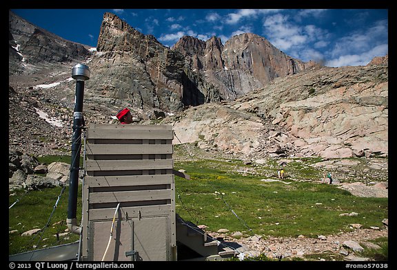
By the time I had photographed the lake to my heart’s content, a substantial number of fit-looking hikers had arrived. It was time to leave, especially since I was to catch the flight home this afternoon in the sprawling Denver International Airport. The trail gets enough visitors that the Park has installed an open-air toilet in the meadow below the lake, providing the best view I have had from a toilet seat. At the trailhead, I found the parking lot – which was empty when I had arrived, since no overnight camping is authorized – to be chock full, with overflow parking along the access road stretching several hundred yards.

View more images from the Chasm Lake hike
View more images from Rocky Mountain National Park.

National Park Foundation calendar covers

For their 2014 Calendar, the National Park Foundation has chosen several of my National Parks images, including for the cover, just like they did in 2013. I know from experience that this is not an uncommon in publishing, but I still find the reversed left-to-right Channel Islands odd. What do you think of the practice ?

I support both the National Parks Foundation and the National Parks Conservation Association, two excellent organizations that work on behalf of our parks. Since they are sometimes confused, let me take this opportunity to clarify their differences.

The National Park Foundation (NPF) calls itself “the official charity of America’s National Parks”. It is “official” in the sense that the NPF was chartered by Congress, is chaired by the US Secretary of Interior (who also overseas the National Park Service) and its board of directors are nominated by the US government. It was started in 1967 by Lady Bird Johnson, First Lady during the presidency of Lyndon B. Johnson, after whom a beautiful grove in Redwood National Park is named. NPF is a “charity” in the sense that funds contributed to the NPF go into programs that directly benefit the national parks. For instance, your gift to the NPF may help fund the restoration of the Elwha River in Olympic National Park, after the NPS began in Sept 2011 the largest dam-removal project in U.S. history.

The National Parks Conservation Association (NPCA) calls itself “the only independent, membership organization devoted exclusively to advocacy on behalf of the National Parks System”. It is an “independent, membership organization”, because it was created as a citizen’s watchdog for the National Park Service, as early as 1919 (the NPS was created in 1916), by none other than Stephen Mather, the first director of the National Park Service, and Robert Sterling Yard. NPCA’s founders understood the parks would need an independent organization to safeguard them. Yard, who served as NPCA’s first executive director, wrote in 1920, “It is the people who must save their own national parks.” This independence make it possible for the NPCA to be critical of the government (including the NPS), while the NPF stays silent on all controversial issues. The main work of the NPCA is “advocacy”, which includes educating the public about the importance of preserving the parks, convincing lawmakers to pass laws to fund and protect the parks, and going to court to help enforce them. For instance, the NPCA, together with allied environmental organizations, lobbied successfully for the passage of the Elwha River Ecosystem and Fisheries Restoration Act (1992) and to secure associated funding.

Theodore Roosevelt’s Elkhorn Ranch

Theodore Roosevelt National Park is unique amongst the 59 National Parks in that it protects not only an exceptional landscape, but also the memory of an exceptional man, the president who did far more for the National Parks and environmental conservation in the US than any other. This summer, I finally visited the place most closely associated with him in the park, the remote and solitary Elkhorn Ranch.

The son of a prominent New York family, Roosevelt first came to the western North Dakota Badlands in 1883, aged 24, to shoot one of the area’s few remaining buffalo. However, he fell in love with the rugged land and lifestyle. Back to New York, his wife and his mother both died on Valentine day of 1884. In June, he returned to the Dakota Territory to grieve. There, he built the character that allowed him to go on to greatness while living the life of a cattle rancher and hunter. The restorative power of wilderness inspired him for his crusade to save wild and special places in the United States.

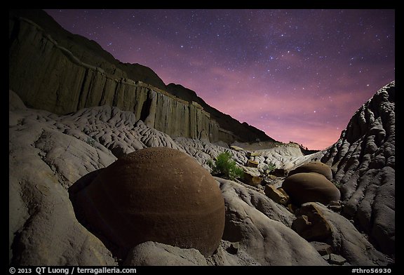
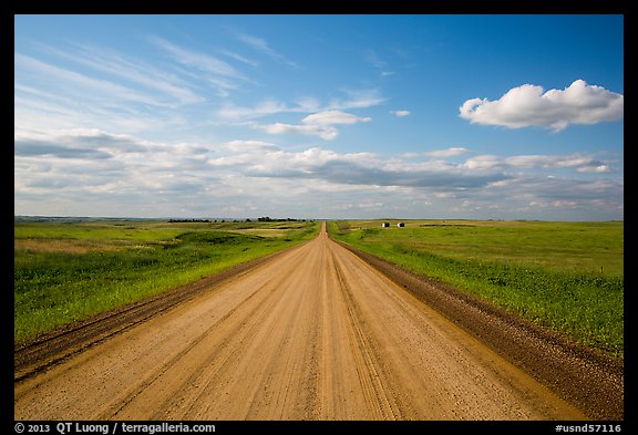
Theodore Roosevelt National Park comprises three separate units. Most visitation occurs in the larger South Unit (photo above) easily accessed from I-94 through touristic Medora. It has a scenic loop drive and the more extensive trail system. The smaller North Unit is much more quiet – in a park which is already amongst the lesser visited. I remember the skies there being pretty dark 10 years ago, but when I returned this summer, as I set out for some night photography, I was surprised by the light pollution (photo below).

During my two previous visits to the park, I had missed the Elkhorn Ranch Unit. I had been told that it is just 218 acres, and accessible only by 30 miles of remote 4WD roads, so I did not attempt to get there with my rented passenger car. In the meanwhile, I had read extensively about environmental conservation in the US and the history of the national parks, so my admiration of Theodore Roosevelt had only grown. Because this is Roosevelts home in North Dakota, I could understand why despite its tiny size it is considered to be the crown jewel of Theodore Roosevelt National Park. This time equipped with a SUV, I resolved to visit the Elkhorn Ranch.

The excellent map provided by the NPS in the Theodore Roosevelt National Park newspaper made is easy to navigate the maze of unpaved roads. If you go there, be sure to obtain it at the South Unit Visitor Center, since the roads are scantly marked, and there is no signage pointing to the Elkhorn Ranch. In dry weather, they did not present difficulties, and in fact did not require 4WD, but I could see them easily becoming too muddy to be passable after rains.

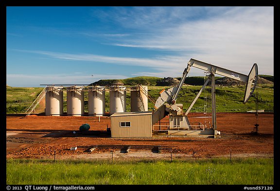
Although I met only a few oil trucks, I noticed quite a few oil wells. Starting with the discovery of the Parshall Oil Field in 2006, the Bakken oil boom has propelled North Dakota to become the number two oil-producing state in the country (just behind Texas), and the state with the lowest unemployment rate, helping the US get to the brink of overtaking Russia as the world’s largest producer of oil and gas combined. The boom brought about a wholesale industrialization of the western North Dakota countryside, resulting in the light pollution that I had noticed in the North Unit.

Arriving in late afternoon at the Elkhorn Ranch site, I did not see any other visitor there. By the time I left, the next mid-morning, no other visitor had arrived. Where else can you experience an entire National Park Unit by yourself for that amount of time ? The solitude could have been as extreme as during the times of Theodore Roosevelt. In 1884, he had came back to the Dakota Territory looking for a new ranch site. After riding 30 miles up the Little Missouri River, he found this site he liked, because of the isolation: “My home ranch lies on both sides of the Little Missouri, the nearest ranch man above me being about twelve, and the nearest below me about ten, miles distant”. He named this ranch – his second one – the Elkhorn after he found the horns of two male elk interlocked at the site. The elk had been butting heads when their horns became locked. Unable to extricate themselves, they died of starvation.

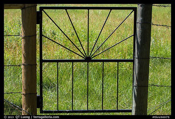
I parked outside the fence, and opened the distinctive gate. The grassy trail consisted only of a band of shorter grass delimited by taller grass. Wonderfully soft under the feet, like a natural carpet, it contributed to the perception that although man had been there, the landscape had minimal development, remaining the way it was, when Roosevelt first found it.

After about half a mile, the trail forked. The right branch went to the Little Missouri River, whereas the left branch led to the ranch site itself, enclosed behind another fence. All that was left are massive foundation stones. Tracing the boundaries of his ranch house, I took in the starkly beautiful view I imagine Roosevelt had from the ranch’s broad veranda. I could immediately feel why he enjoyed it so much. Although both the South Unit and North Unit have more spectacular views or interesting rock formations, there was another kind of more intimate beauty on display here.

The large cottonwoods – some of which date from Roosevelt’s time – and meadows lining the Little Missouri created a sense of serenity amongst the rugged badlands. This was the most inviting and peaceful site I had seen, through the more than thousand miles I had driven in a week, from Rocky Mountain National Park, through the Badlands and Black Hills of South Dakota. For the first time on the trip, where as usual I was trying to do too much, I relaxed and just laid in the grass, listening at the cottonwood leaves quake in the wind and the birds sing.

In the late 19th century, Roosevelt witnessed from there the environmental degradation in the Badlands wrought by overgrazing and overhunting, an experience that led directly to the development of his influential conservation beliefs. The idea of the national government taking an active role in the conservation of America’s natural resources has roots in Roosevelt’s experiences at the Elkhorn Ranch. For this reason, the place has been called “cradle of American conservation” and considered by many as a hallowed shrine. I wondered, if Roosevelt was returning today, what would he have thought of the distant rumble of pump jacks that can be heard from the ranch site, which can only increase as the oil boom continues ? For now, the view remains the same as Roosevelt saw it, but for how long ?

View more images of Theodore Roosevelt National Park
View more images of the Elkhorn Ranch Unit

The Everglades in Summer

Being sub-tropical, South Florida has only two different seasons. The wet season starts around the middle of May and continues through to November with the last major storms. During this time, South Florida gets a lot of rain and everything gets really wet. The dry season runs from December through April. During this season, everything starts to dry up in a short amount of time. Not only are temperatures cooler, but the dryer air also make the air feel more crisp.

In the past, I had always recommended a winter visit to the Everglades, writing for instance in a handout for my 2010 NANPA Summit presentation: “During the rainy summer season, water submerges most of the Everglades, spreading out the wildlife. As water bodies shrink during the dry winter season, countless birds gather at the water holes, making it easy to photograph them. Winter offers the smallest concentration of mosquitoes in Everglades and Biscayne, as well as pleasant conditions, while summers are hot and humid.”

Common wisdom agrees, since the high tourist season in South Florida is indeed winter, when prices for lodging climb sharply and Everglades National Park schedules most of its activities. Many photographers come to the Everglades primarily to photograph the birds, for which winter is the season of choice. However, not all photographers operate under common wisdom. For my specialty, landscape photography, I had long guessed that summer could actually present the best conditions. This summer, I had the chance find out for myself.

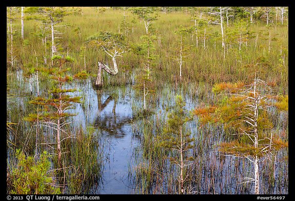
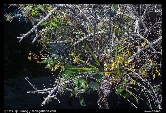
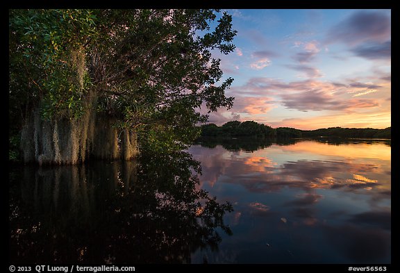
At first glance, I noticed that during the wet season, the vegetation looks green and lush, whereas in winter it is kind of brown and dead-looking. High water levels enable beautiful reflections.

I saw this native Butterfly Orchid, which blooms only during the summer, as well as the Pond Apple, and several others.

During the winter skies are often cloudless all day. In summer powerful afternoon storms move in daily. Those storms are often localized, with an extension of less than 10 miles, so the sky is not all overcast. This means dramatic skies, an important element in a very flat landscape.

Clouds also translate into beautiful sunsets. Behind this serene image, some danger lurked. Paurotis Pond in Everglades National Park is bordered by thick vegetation with just a few openings, so to get a good perspective I had to wade in the water while keeping an eye for an alligator hanging out at the other end.

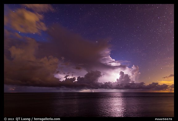
The super-heated storms produce frequent lightening, relatively easy to photograph because the storms are so localized. While it takes some luck to capture such an image with a single frame, setting up the camera to fire long-exposure continuously, I was sure not to miss anything and I got a time-lapse as well.

The state of Florida spends a great deal of resources to control the mosquito population, particularly in high tourist areas like the Keys. Of course, such programs are not applied in a protected area such as Everglades National Park. I was surprised that mosquitoes weren’t much of a problem during the day even in the heart of the park. However, at night they were definitively in full force, even in the pinelands, which is the areas where they are normally the less dense.

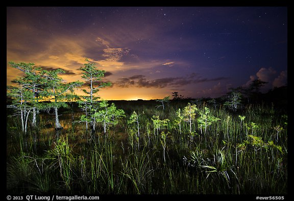
In the swampy areas – which is to say most of the Park – bugs got much worse. However, I came well equipped, with the Bug Shirt based on a recommendation from local photographer Paul Marcellini (do not miss his excellent Everglades Photography E-book if heading towards the area). Even though, it was difficult to concentrate because of the loud buzzing around. The mesh used to keep mosquitoes off your face also makes everything look darker, which does not help at night. I used my headlamp, standing on the side for cross-lighting, to illuminate the dwarf pond cypress. Light on the horizon is from the Miami metro area. The clouds continued to enhance the sky, even at night !

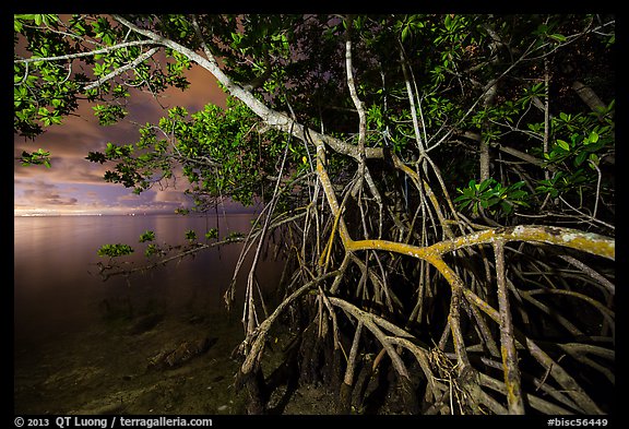
I felt confident enough in my bug protection to walk a mile (each way) into Biscayne National Park, to photograph the mangrove coast at night, when the access road was closed. During the day, the light is always difficult there, but at night a lantern provided nice illumination for an image not commonly seen.

On this trip, I actually spent the bulk of my time in the Dry Tortugas, where the summer conditions were great, but based on what I saw, despite the uncomfort of the season, I plan to return at some point to the Everglades in summer.

See more images of Everglades National Park

History Channel 2014 calendar + National Parks ranked

For their official 2014 Calendar, the History Channel Club has chosen 12 of my National Parks images, including 12 parks not featured in their 2012 calendar: Wrangell St Elias, Arches, Biscayne, Grand Teton, Big Bend, Saguaro, Olympic, Death Valley, Shenandoah, Isle Royale, Redwood, and Haleakala.

Speaking of National Parks selections, The Active Times recently embarked on the almost Sisyphean (and akin to a parent picking a favorite child) task to rank all 59 of the National Parks, considering factors such as accessibility, the diversity of activities available, biodiversity and straight-up awe factor. What is The Active Times ? A relatively new website dedicated to the outdoors, fitness, endurance and adventure sports launched in June 2012 by former Forbes.com CEO Jim Spanfeller and John Rasmus, founding editor of Men’s Journal and National Geographic Adventure. In the process, they asked me for my list of top 20 parks – a good answer to the frequently asked question “what are your favorite national parks ?”. See how it differs from their final list of 59 parks ranked. I’d love to hear about YOUR favorites !
A summer visit to Dry Tortugas National Park

In July, I returned to Dry Tortugas National Park. Considering that I had visited the Park three times before, each visit longer than the previous, and that its main area, Garden Key, has a tiny size of 400 meters by 500 meters, 3 days/2 nights may sound a lot of time to spend, but this turned out to be barely enough to create the new images I had planned.

As described in much detail in post #37 of National Parks Photo Spots series, I have photographed one favorite view quite a few times, but had not been successful in capturing it with sunset colors. My first two visits were day trips. On my only overnight stay, a decade ago, cloudy skies meant that the sunset was a monochromatic blue. This time, I got two good chances to create images with a mix of warm and cold hues. On the first evening, the clouds were low, so the color was great looking West, but kind of muted looking North. The second evening was more favorable, so having two chances was useful.

Last time I visited, the first full frame digital camera had yet to be released. This time, I felt confident shooting at ISO 3200 on the 5Dmk3, which let me work in the middle of the night. Despite the 1.4 maximum aperture of my 24mm lens, 30s (maximum shutter speed for point stars) were still necessary as the tropical sky was partly cloudy. Fortunately, distant thunderstorms intermittently illuminated the sky. In winter, the seas can be rough. With no waves sweeping over the seawall in the calmer weather of summer, I was able to leave my camera all night with an intervalometer and capture those flashes of light, part of a time-lapse sequence.

Camping on Dry Tortugas is a wonderful experience. A cluster of trees provide shade for most of the spots, which are only a minute walk from the beach. Because there is no freshwater on the island (“Dry”), there are no mosquitoes unlike on Florida mainland. During the day, up to 200 visitors arrive with the daily Yankee Freedom ferry and the seaplanes. A day visit doesn’t leave much time: the ferry arrives around 10.30, and leaves at 2:45. By mid-afternoon, day-trippers are gone, so that you share the island with at the most one or two dozen campers. In late afternoon, when the light is less favorable for underwater explorations, and the sun less harsh, the fort is deserted.

A bit of planning is necessary, since camping there is primitive: facilities are limited to clean chemical toilets, except during the time when the ferry is docked when you can use its facilities and get some iced water as well, and the Fort itself could make for an excellent emergency shelter. Everything you need, in particular food and water, has to be brought, however I had no difficulty handling all my gear, which included a huge duffel bag, heavy Pelican case containing a underwater housing, camera bag, and large cooler. Wheelbarrows are available at the deck in Key West and at Garden Key. The official stated 60 lbs per person luggage limit isn’t really enforced by the Yankee Freedom crew. The only thing I have to warm you is to make reservations for camping transportation well in advance. The National Park will not deny you a camping spot (first come, first serve, stake shady spots quickly !), but the Yankee Freedom has a strict limit on the number of campers they will transport on each trip. Besides ample time, sunset, sunrise, and night photography opportunities, you get to witness the daily cycles of life on the island, such as thousands of colorful hermit crabs of all sizes and shapes crawling up all the place, even trying to scale trees, in the summer evenings.

Garden Key is the centerpiece of the park and the only frequently visited key, but of of the seven diminutive Keys that make up the Dry Tortugas, Loggerhead Key is actually the largest. Maybe because it is home to one of the tallest lighthouses in Florida, it appears deceptively close, but is separated from Garden Key by three miles of open ocean. Only a maximum number of 24 visitors are allowed each day on Loggerhead Key, but this number is almost never reached, since there is no public transportation from Garden Key to Loggerhead Key. In winter and spring, high winds make the crossing problematic. I rented a sea kayak in Key West from Marty Stonely, who specializes in renting kayaks to be taken to the Tortugas. Marty arranges for the kayak & gear to be delivered and picked-up at the ferry pier, and also provides safety equipment, including the essential marine radio. After observing the weather patterns on the first day, I became weary of the tropical storms. They could appear out of nowhere, at any time of the day. One minute, you are sweltering under the tropical sun, but before you know it, the temperature drops by 15 degrees, torrential rains soak you, and as you are buffeted by high winds, all of a sudden staying on course and keeping warm becomes a concern when you have no place to hide.

I was still planning to paddle solo to Loggerhead, but then I was fortunate that captain Glenn Patron, Gale, Ron, and Jean were also planning to sail to Loggerhead Key that day on their 50-foot sailboat Encore. I am extremely grateful to them for letting me ride along and for their kind hospitality on that day. On the way to Loggerhead Key, we did get hit by a tropical storm in the morning, and had to wait it out for more than one hour before we could dive the Windjammer. I was glad not to be on the water by myself since I am not sure I would have had the fortitude to continue in those conditions. Like the other keys of the Tortugas, Loggerhead Key is almost entirely covered in sand, with little arable land, so the vegetation is desert-like. There are also long and totally deserted beaches, but the main draw of Loggerhead Key are its outstanding reefs.

The total surface area of Dry Tortugas National Park is 64,701 acres, but only 104 acres are above water. This means that the park is more than 99% water. While winter is the popular season in Florida because of the cooler temperatures, lack of oppressive humidity, rain, and biting insects, summer is the better time for underwater activities, because the water is warmer, calmer, and clearer. I thought that a split-image would illustrate best the idea of the improbable Fort Jefferson rising out of pristine tropical green-turquoise waters. I photographed at mid-day so that more light would penetrate the water. To execute such an image, you need to have a large contact surface between optics and water. The Nikonos I previously used doesn’t work for this. This time, I had a 5Dmk2 with a 17-40 and a +2 diopter inside an Ikelite underwater housing equipped with a 8-inch dome port.

The reefs of Dry Tortugas lie in the Gulf of Mexico, at its juncture with the Atlantic Ocean and the Caribbean Sea. The intermixing of those three ecosystems results in a one-of-a-kind collection of marine life which is totally protected in the National Park and quite undisturbed because the remoteness of the location. Just outside the fort seawall, the snorkeling is already good, with an abundance of corals visible as you stroll the seawall, and it gets more interesting as you swim away.

The best snorkeling in the park is found in two sites off Loggerhead Key. The Windjammer is the most popular dive site in the park. It is the nickname of a three-masted ship that wrecked on Loggerhead Reef in 1901 and since then has be resting in shallow water. The structure forms an artificial reef attracting a host of fish from small tropicals to huge jewfish. The maximum depth is 20 feet, with a small piece of wreckage breaking the surface, making the site also suitable for snorkeling. I wished I had scuba gear, since photographing while free-diving is much trickier with a large camera housing, however for logistical reasons, the only practical way to scuba dive the Tortugas is to come on a live-aboard diving boat.

Located off the north side of Loggerhead Key, and easily accessed from the beach, Little Africa Reef (named for its shape), is protected and calm. It had the densest concentration of corals at shallow depth I saw anywhere. I could hardly find any sandy spot to stand, and the water was so shallow than you had to swim in zig-zag in order to avoid touching the corals. The shallow depth made it possible to capture vivid colors, even without a strobe, which is always difficult to handle while free-diving.

Our explorations of Loggerhead Key took an entire day. On my last day, I had to pack my gear to have it ready on the dock at 10:30, so the time went pretty fast. By comparison, see the perspective of a day traveling family on what to see and do in Dry Tortugas. In retrospect, I wished I had stayed for the maximum of three nights allowed, as there were still spots on and around the island that I did not explore, even though at this point my gallery of pictures of Dry Tortugas National Park is already the most comprehensive on the web.

Mui Ne Beach, Vietnam

The Ho Chi Minh City project is simply “The image of the President in the City”: in each of the photographs, all made in Ho Chi Minh City, there is a depiction of Ho Chi Minh, for instance as framed portrait, poster, sculpture, bust, post stamp, post card, or book cover. The continued presence of that image in several contexts amongst contemporary city life evokes several political and social issues related to communism, control, influences, history, and change, but rather than offering an answer, each photograph in the series remains open to individual interpretation. There is little contest that Ho Chi Minh was one of the most influential leaders of the 20th century (for the better or the worse, depending on whom you speak to), but nowadays that Ho Chi Minh City is at a center of a free-market economy, what is his legacy beyond a carefully cultivated figurehead image ? Is he still admired by the common people, or just a subject of a cult of personality ? Is he a sinister big-brother figure, an obsolete icon to whom nobody pays attention anymore, or a reassuringly familiar and respected symbol ? The photographs contain evidence for multiple readings.

Now for a contrast to this project, in this post I am presenting images of traditional – some would say eternal – Vietnam, photographed on the fishing beach of Mui Ne. I’ve posted before about the sand dunes, do you recognize this image, a gift to my subject ?. Once a sleepy fishing village famous for its fish sauce, Mui Ne has become in the last decade a popular resort town, whose main street is lined up with so many resorts on the ocean side that tourists outnumber locals on the sidewalks. Yet life hasn’t changed much over the years elsewhere.

If you go just a kilometer north of the main tourist area, the resorts become more sparse. Instead of catering to Western or Russian foreigners, their clientele consists of domestic tourists, mostly Saigonese on a quick getaway. Last December, while traveling with my family, we stayed at one of those resorts. The rate was good, the rooms less so. The folks from the neighboring room invited me to share some fish and beer. Unlike in the more expensive tourist area, the resort with surrounded by private houses belonging to fishermen. The following images were all made from less than a hundred yards from our beach-facing room from which we could observe their activities from dawn to dusk (more images).

A few more kilometers north, you get to the fishing village (Lang Chai). Down a long flight of stairs, the beach there is an early morning gathering place where fish and shell sellers wait for the fresh catch from on night’s work on the sea (more images).

Ho Chi Minh City project

For family reasons, I’ve been spending a fair amount of time in Ho Chi Minh City almost every year. Besides photographing sights all over the city, as well as many aspects of everyday life, I’ve been working on a more focused project. Here are a dozen images from that series. Can you guess what the series is about – the common element in each image ? Answer in the next blog post ! More images from the series and hints on Facebook and Google+.

Pinnacles National Park

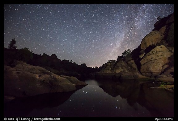
I’ve not blogged much recently because I’ve been traveling this summer. I’ve quite a backlog of National Parks images to edit and process. The ones that I did process are from our newest National Park: Pinnacles.

The legislation for the new status was signed by President Barack Obama on Thursday, January 10, 2013. On January 11, the first day Pinnacles opened as a National Park, I arrived at the East Entrance at the crack of dawn. Instead of the spectacular rock formations for which the park is named, the first image of the new National Park that I made depicts grasses and shrubs covered with a layer of frost which would melt away a mere half-an-hour later. It is almost certainly the first large format photograph made in Pinnacles National Park.

As part of my National Park project, in the first half of 2013, I photographed Pinnacles more thoroughly, resulting in maybe the second most extensive gallery of photos of Pinnacles on the web. One afternoon, in order to photograph the namesake rock formations, I hiked up the High Peaks (1,200 feet elevation gain) with my 50 lbs large format camera bag to photograph at sunset. The sunset was weak. I didn’t take a single picture with the 5×7 that day and hiked down entirely in the dark. After a short night, the next day, I hiked up in the dark, arriving at a pre-scouted location half an hour before sunrise. However, just at sunrise, some clouds lighted unexpectedly and didn’t fit the composition I had set up with the 5×7. I frantically tried to recompose: take the holder out, open the lens, get the dark cloth on, move the camera, close the lens, stop down the lens, re-insert holder, re-meter. By the time I was done, the light, which lasted only minutes, was gone. I was left with he following large-format image:

I like this pair of images for the contrast between the cold and the warm, the intimate and the spectacular.

Pinnacles was one of the oldest national monuments in the nation, having been established in 1908 by none other than President Theodore Roosevelt using the power given him in the Antiquities Act of 1906. At that time, though, there were no drivable roads into the Monument, and in 1922, the superintendent of Yosemite National Park, after a quick survey visit, even recommended that the monument be abandoned. By the late 20th century, the value of the area had become clear. Only Congress can designate a national park, but many national parks began as national monuments designated by presidents.

I’ll dwell a bit of the history of the bill which re-designated Pinnacles into a National Park because it sheds some light on the workings of the US Congress. It is the brainchild of Democratic Congressman Sam Farr who represents California Central Coast (Carmel – CA-20) district – who had been working on this since since he was elected to Congress in 1994. Its main goal was in fact to boost tourism dollars to the local area, since National Parks draw more visitation than National Monuments. The legislation consists in essence of just designation changes: Pinnacles National Monument becomes Pinnacles National Park, Pinnacles Wilderness within becomes Hain Wilderness (after Schuler Hain, an early 20th century proponent of Pinnacles National Monument), and is expended by 3,000 acres using existing park land. You’d think that given that there are almost no costs, it wouldn’t that hard to pass.

However, first introduced in the House of Representatives in 2009, the bill got nowhere, dying inside a committee without getting to the floor for a vote. In 2011, Sam Farr tried again, with the help of a Republican ally (Jeff Denham CA-19) who co-sponsored the bill. This time with bipartisan support, the bill cleared up the House in July 31, 2012, but not before Sam Farr was forced in the House subcommittee to remove expansion of the Hain Wilderness within the park – that Congress was the 1st one not to designate any single additional acre of Wilderness. Senate was to vote quickly on the bill, but a senator put a “hold” on it using arcane rules, because of an unrelated dispute about public lands and fisheries in South-East Alaska from where the relevant senate committee chairwoman hails. Without action in the senate, when 2012 ends, the whole process would have had to be restarted again from the House. Eventually the Senate got their act together at the 11th hour, passing the bill on Dec 30, 2012.

I had visited Pinnacles National Monument in the year I arrived in California, 1993, for the same reason that initially drew me to Yosemite: rock climbing. I also occasionally returned to Pinnacles just for hiking. Although other areas have more resources, I am pleased with the recognition Pinnacles is getting. Only an hour and half away by road, Pinnacles is the closest national park to where I live. The park’s area is quite small. At 38.3 sq miles (99.2 sq km), it is one of our smallest National Parks. But as it is not crossed by a road, the park feels larger, since you have to explore it on foot. To my surprise, I found within the Pinnacles one of the steepest trails that I have ever hiked, kind of similar to Half-Dome, but with barbed wired to pull yourself up instead of cables. For 12 miles, I did not see a single soul. It remains to be seen how the re-designation will increase park visitation. I don’t expect the park do become crowded. However, as the trailhead parking for Bear Gulch, the most popular area in the park, is shockingly small, I could foresee a shuttle becoming mandatory on busy weekends in the spring.

Unlike parks like Yosemite, Pinnacles does not have icons, so the park rewards personal seeing. Only an hour and half away from the major metropolitan areas of the San Francisco Bay area, an isolated, wild, and quiet area where a variety of subjects awaits your exploration: spectacular rock formations, expansive vistas, rare talus caves, a beautiful and reflective body of water, an abundance of wildflowers in the spring, and dark skies. I’ll write in more detail about my findings in Pinnacles National Park at another times, but for now I’ll let the images speak for themselves. Please let me know if you have any favorites, and if you have any questions about locations, feel free to ask.

More images of Pinnacles National Park

Hawaii Volcanoes time-lapse video: notes and stills

Thanks to everybody for the interest in my newly released video, Hawaii Volcanoes, which was played more than 35,000 times on Vimeo in the first week. Although information about the scenes depicted is available elsewhere on the blog, I wrote this post to collect it in a single spot for the benefit of viewers. High-res stills from the video may be downloaded for personal use or posted (with link & credit) in write-ups about the video.

The rising sun colors the sky above the immense summit caldera of Mauna Loa, an active volcano, as evidenced by the fumaroles on the floor. Few get to see this scene: I did not meet a single person there for the entire day. Hiking Mauna Loa is an arduous 13 mile journey on mostly trail-less lava rocks during which I did not see a single plant. This could be another planet.

Next to the Kilauea caldera, fumaroles and endemic Ohia trees (see also next image) are backlit by the rising sun. The Hawaiian islands are further away from a major land mass than any other. Plants who managed to make the voyage to the once barren islands evolved into more specialized life forms. Over 80 percent of Hawaii’s native flora and fauna is found nowhere else in the world.

Kilauea is the world’s most active volcano, erupting continuously for thirty years. Halemaumau crater – home to Pele, Goddess of Hawaiian Volcanoes according to the traditions of Hawaiian mythology – is a pit crater within Kilauea caldera. During my two first visits there, a decade ago, I could walk to the edge of the crater, which is no longer possible because in 2008, a series of explosive eruptions awakened the Halemaumau crater, which now spews a dangerous sulfur dioxide plume day and night.

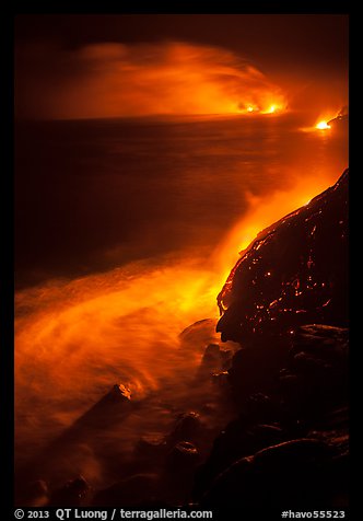
Lava flows several miles from the center of the eruption, and eventually meets the ocean, forming a acid gas plume when it contacts water. Unlike most, the lava from Hawaii volcanoes is very fluid, creating the rope-like patterns. As there is little danger of explosion, I could approach the 2000 Fahrenheit degrees lava to a few feet, until the heat became unbearable.

One of the most mesmerizing spectacles of nature you will witness is glowing lava cascading into the ocean to form new land in front of your eyes, which is instantly destroyed by the action of the ocean. I had to be careful not to stand on unstable lava cliffs, since they are known to collapse into the ocean without warning. More about photographing the lava ocean entry in Hawaii.

Most of the time, lava flows underneath the surface. The first time I returned at night, its glow through cracks startled me, since by day I had stepped onto the freshly hardened lava, unsuspecting that molten lava was flowing underfoot. In the background, lava cascading into the ocean illuminates the plume and land. After everybody had left, I stayed to record the pulse of the flow over an entire night.

At night, molten lava, forming a lake at shallow depth within the Halemaumau vent, create a spectacular incandescent illumination. The juxtaposition with the Milky Way shows creation through violent gases from two time eras, the distant past of the stars, and the present on earth. I captured it appearing in a weather break above by setting up my camera in driving rain, protecting it with an improvised cover so I could leave it all night.

At 10,500 feet, Haleakala is one of the world’s largest dormant volcanoes. As a tall peak on an island, its summit is often floating above clouds, on top of the inversion layer separating lower maritime air from upper atmospheric air. The sunrise from the top of the crater is considered by many to be the “most beautiful sunrise in the world”, prompting many to leave their resorts at 2am to witness it.

In an opening in clouds, the distinctive shield volcano shape of Mauna Loa on the Big Island is seen one island away from Haleakala on Maui. Mauna Loa’s very gently slopping 10000 cubic miles makes it the world’s most massive mountain. The world’s largest volcano, it rises just 13700 feet above sea level, but its 42000 feet below the sea make it the tallest mountain from base to summit.

Despite temperatures (in Hawaii !) that left my water bottle frozen solid in the morning, fierce winds, and altitude sickness, I camped on the 13700 feet Mauna Loa summit, above 600 feet vertical cliffs, so that I could capture an all-night time-lapse sequence, likely the first ever made in this place. More about Hiking Mauna Loa summit via Observatory Trail

Check out my extensive collection of images of Hawaii Volcanoes National Park.