Photo spot 29: Isle Royale National Park – Rock Harbor to Chippewa through Greenstone Ridge
No Comments
After North Cascades National Park, the second least visited of the National Parks in the continental US, we turn our attention to the least visited, Isle Royale.
While at first, the visitation numbers for North Cascades may sound surprisingly low, it is easy to see why Isle Royale sees so few people. Isle Royale is a large island in Lake Superior. After a crossing lasting between 3 and 7 hours (Grand Portage to Rock Harbor) on the often rough Lake Superior waters, you are on your own as soon as you land in this wilderness, roadless park. Everything that you need must be packed in (and out). Day visitors must hurry for a few hours of sightseeing, much less than the time they spend on the boat. Although there are fine day hikes from Windego and Rock Harbor (the two main landing spots), to truly explore the island, you need to backpack. Indeed, Isle Royale visitors stay on average on the island for 4 days, while the average visitor to a national park stays for just 4 hours.
To acknowledge that fact, instead of describing just a spot like in the other posts, I will describe an entire itinerary. While crossing the entire length of the island requires four to five days, mine is a shorter route that includes some of the most scenic trail portions, and allows you to sample the various environments of the island in only three days, with ample time for photography. It takes advantage of a mid-island stop made by the ferry M.V. Voyageur II from Grand Portage. Be sure to notify the captain so that you will be picked up at Chippewa, otherwise, you may be stuck in the backcountry ! In addition to the backpacking days, there are two days of travel on the ferry, typically Grand Portage 7.30am- Rock Harbor 3pm, and Chippewa 9am – Grand Portage 3pm. On your day of arrival on the island, I recommend a hike from Rock Harbor to Coville Point instead of going to the Three-Mile or Daisy Farm campground.
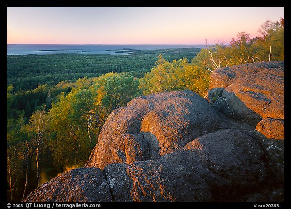
- Day 1: Rock Harbor to Mount Franklin (8.5 miles): Follow the shore of Rock Harbor (some interesting views betwen Suzy’s cove and Three mile campground) , then ascend to the ridge (about 1000 feet elevation gain) through the Mount Franklin trail, passing a beaver marsh. Mount Franklin has a few rock formations and great views looking towards the North, beautiful at sunset. There is no established campground nearby, however you can bivy on hard surfaces.
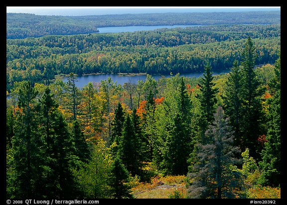
- Day 2: Mount Franklin to West Chickenbone (10 miles). Follow the Greenstone Ridge. Although the trail runs on the backbone of the park, it is mostly forested, except for the mile around Mount Ojibway. From near the tower, you have especially fine views towards the West over the lakes within the island. The West Chickenbone campground is situated in a pretty area near the shores of West Chickenbone lake. Check also views over Lake Livermore to the south of the trail.
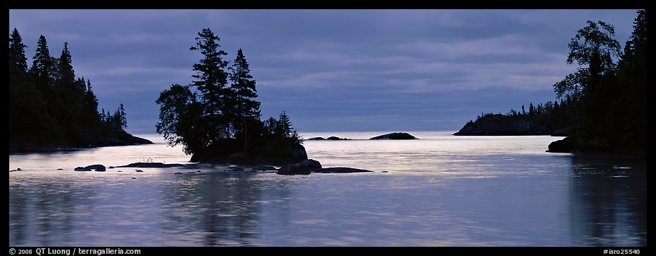
- Day 3: West Chickenbone – Chippewa Harbor (7.9 + 4 miles). From West Chickenbone, consider an optional early morning hike towards Mount Siskiwit on the Greenstone Ridge (leave overnight gear at trail junction): for maybe a mile, the trail is in a thick forest, but but after a steep climb, you reach a good view of the inland lakes, and then a long stretch of an open crest not obscured by trees that continues to Mount Siskiwit. Back on the main route, on the way to Chippewa Harbor, you will follow the shore of Lake Ritchie. Chippewa Harbor is particularly interesting at sunrise, with an isolated group of trees on a small islet. There are open cabins with mosquito nets and tables, so you don’t need to pitch your tent.


View more images of Isle Royale National Park

