terragalleria.com · the photography of QT Luong
Home / USA / Alaska / Richardson Highway
[ Color | Black & White ]
New book: Our National Monuments - America's Hidden Gems
    How to buy prints or license images
Previous pictures: Denali Highway photos

Richardson Highway

Pictures by QT Luong

photos Next pictures: Steese Highway
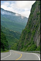
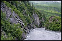
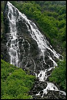
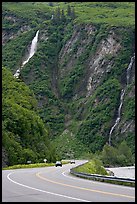
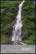
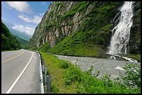
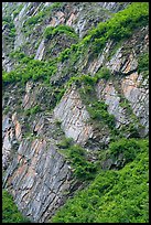
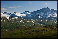
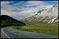
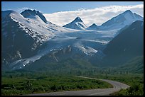
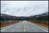
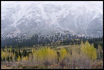
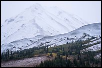
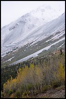
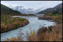
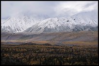
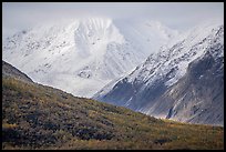
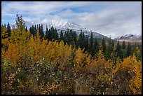
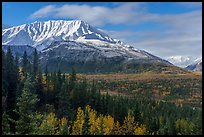
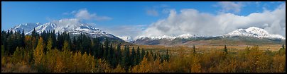
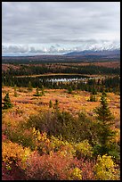
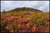
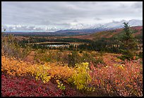
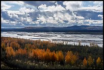
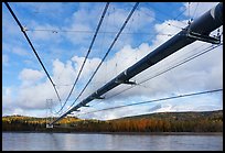
The Richardson Highway runs mostly North-South between Fairbank and Valdez. The Richardson Highway is a road with superb scenery. Near Valdez, it passes the multiple-armed Worthington Glacier, the high Thompson Pass with the record snow accumulation in Alaska, and the Keystone Canyon with its many waterfalls that almost plunge onto the road from steep and verdant canyon walls. Between Glennallen (junction with the Glenn Highway), and Delta Junction (junction with the Alaska Highway), the Richardson Highway crosses the Eastern Alaska Range, offering spectacular views of mountains and easy access to glaciers.

[CLICK on any picture to see a larger image and details, to add to selection, to order, and to download wallpaper.]

High Speed catamaran Chenega of Alaska Marimite Highway unloading in Valdez. Alaska, USA ( color) Peter Toth huge wooden carving of a Native American. Alaska, USA ( color) Richardson Highway passing between steep walls, Keystone Canyon. Alaska, USA ( color) River, vegetation covered rock walls, Keystone Canyon. Alaska, USA ( color) Horsetail Falls, Keystone Canyon. Alaska, USA ( color) Richardson Highway and waterfalls, Keystone Canyon. Alaska, USA ( color) Bridalveil Falls, Keystone Canyon. Alaska, USA ( color) Bridalveil Falls cascading next to rood, Keystone Canyon. Alaska, USA ( color) Vegetation and rocks on canyon walls, Keystone Canyon. Alaska, USA ( color) Jagged peaks above Thompson Pass. Alaska, USA ( color) Richardson Highway below Thompson Pass. Alaska, USA ( color) Richardson and Worthington Glacier, afternoon. Alaska, USA ( color) Trans-Alaska Pipeline and mountains. Alaska, USA ( color) Trans-Alaska Pipeline. Alaska, USA ( color) Alyeska Pipeline and mountains. Alaska, USA ( color) Gas station The Hub of Alaska, Glennalen. Alaska, USA ( color) Cars and Rv at gas station The Hub of Alaska, Glennalen. Alaska, USA ( color) Richardson Highway and Eastern Alaska Range mountains. Alaska, USA ( color) Trees in autumn foliage and snowy slopes, Rainbow Mountain. Alaska, USA ( color) Pockets of trees below snowy peaks in mist, Hayes Range. Alaska, USA ( color) Trees in autumn foliage and Rainbow Mountain in mist. Alaska, USA ( color) Delta River in autumn, Eastern Alaska Range. Alaska, USA ( color) Snowy mountains of Hayes Range rising from autumn forest. Alaska, USA ( color) Clearwater Mountains in autumn. Alaska, USA ( color) Autumn shrubs and Bivouac Peak, Eastern Alaska Range. Alaska, USA ( color) Bivouac Peak and Delta River valley. Alaska, USA ( color) Hayes Range from Black Rapids Glacier Viewpoint. Alaska, USA (Panoramic color) Tundra and Granite Mountain in autumn, Hayes Range. Alaska, USA ( color) Donnelly Dome in autumn. Alaska, USA ( color) Shrubs in autum and Eastern Alaska Range. Alaska, USA ( color) Tanana River from Alaska Range Viewpoint. Alaska, USA ( color) Trans-Alaska pipeline crossing Tanana River, Big Delta. Alaska, USA ( color)
There are 32 color pictures of Richardson Highway on this page