terragalleria.com · the photography of QT Luong
Home / USA / Alaska / Dalton Highway [ page 1 of 2 ]
[ Color | Black & White ]
New book: Our National Monuments - America's Hidden Gems
    How to buy prints or license images
Previous pictures: Steese Highway photos

Dalton Highway

Pictures by QT Luong

More pictures of Dalton Highway Next pictures: Wiseman
[page 1]
[page 2]
[All]
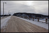
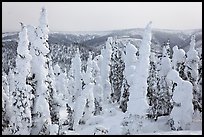
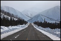
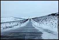
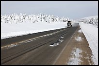
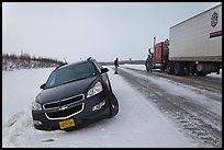
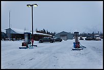
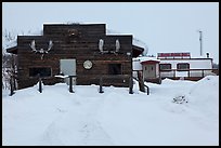
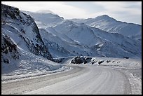
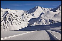
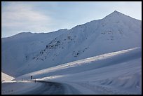
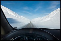
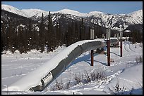
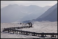
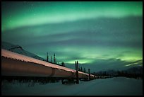
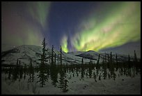
The Dalton Highway was built in 1974 to support the Prudhoe Bay oil fields and Trans-Alaska pipeline. It is traversed daily by more than a hundred 18 wheelers trucks, but it wasn't until 1994 that the whole Dalton Highway was opened to public traffic. The Dalton is the northernmost highway in the US, ending at Deadhorse near the Artic Ocean. The coldest temperature ever recorded in the United States -82F (-62C) was measured at Prospect Creek, near mile 124. The Dalton Highway is also the most isolated highway in the US, as along its 414 miles (667 km) there are services only at one place: Coldfood (population 13) at mile 175. Currently the road is only about half-paved. Gravel flies in summer, while the northern part of the road consists of solid ice in winter. All this has contributed to the Dalton Highway's reputation as one of the most dangerous roads in the world.

[CLICK on any picture to see a larger image and details, to add to selection, to order, and to download wallpaper.]

Long wooden bridge across Yukon River. Alaska, USA ( color) Forest plastered in snow. Alaska, USA ( color) North Slope Haul Road. Alaska, USA ( color) Windblown drifted snow across Dalton Highway. Alaska, USA ( color) Arctic Circle marker, Dalton Highway. Alaska, USA ( color) Dalton Highway bordered by snow-covered trees. Alaska, USA ( color) Car stuck in snow along Dalton Highway. Alaska, USA ( color) Coldfoot in winter. Alaska, USA ( color) Log cabin and Slate Creek Motel, Coldfoot. Alaska, USA ( color) Mount Sukakpak in winter. Alaska, USA ( color) View down from Atigun Pass. Alaska, USA ( color) Arctic Mountains in winter. Alaska, USA ( color) Atigun Pass in winter. Alaska, USA ( color) Frozen Dalton Highway, Atigun Pass. Alaska, USA ( color) James W Dalton Highway at its highest point at Atigun Pass. Alaska, USA ( color) Road in wintry landscape seen from dashboard indicating -32F temperature. Alaska, USA ( color) Trans Alaska Oil Pipeline in winter. Alaska, USA ( color) Alaska Pipeline snaking below Arctic Brooks mountains in winter. Alaska, USA ( color) Trans Alaska Oil Pipeline at night with Northern Lights. Alaska, USA ( color) Aurora Borealis illuminating winter sky and forest. Alaska, USA ( color) Northern Lights and starry night sky, Brooks Range. Alaska, USA ( color) Multicolored Northern Lights above Mount Sukakpak. Alaska, USA ( color)
There are 22 color pictures on this page out of 43 color pictures of Dalton Highway.