terragalleria.com · the photography of QT Luong
Home / USA / California / Northern California / Northeast California [ All images ]
[ Color | Black & White ]
New book: Our National Monuments - America's Hidden Gems
    How to buy prints or license images
Previous pictures: Lava Beds National Monument photos

Northeast California

Pictures by QT Luong

photos Next pictures: Sacramento
[View fewer pictures per page]
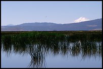
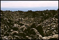
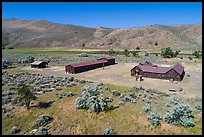
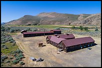
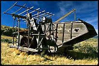
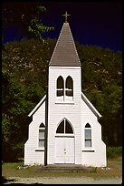
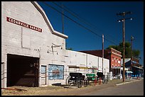
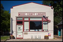
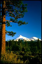
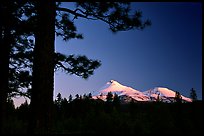
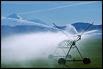
Remote Northeast California marks the southern limit of the Cascade Range, a chain of mountains that run up to British Columbia. The Cascades are part of the Pacific Ring of Fire, the ring of volcanoes around the Pacific Ocean. The range is still volcanically active: 
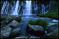
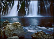
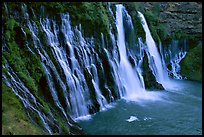
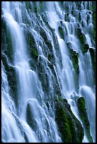
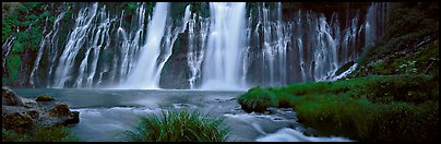
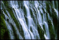
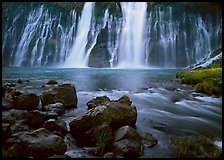
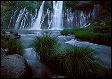
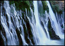
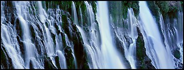
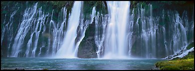
Lassen Peak erupted in 1911. Half-way between Mt Shasta and Lassen Peak, is Mc Arthur-Burney Falls state park, one of California oldest. The wide waterfall over volcanic rock was called a wonder by Teddy Roosevelt.

[CLICK on any picture to see a larger image and details, to add to selection, to order, and to download wallpaper.]

Pines and Mt Shasta seen from the North, late afteroon. California, USA ( color) Mt Shasta seen from a marsh in the North. California, USA ( color) Lava fields, Glass Mountain. California, USA ( color) Burney Falls, McArthur-Burney Falls Memorial State Park, early morning. California, USA ( color) Boulders and waterfall, Burney Falls State Park. California, USA ( color) Burney Falls, McArthur-Burney Falls Memorial State Park. California, USA ( color) Close-up of Burney Falls, McArthur-Burney Falls Memorial State Park. California, USA ( color) Wide Burney falls. California, USA (Panoramic color) Close-up of Burney Falls, McArthur-Burney Falls Memorial State Park. California, USA ( color) Aerial view of Camp Tulelake former CCC camp which housed Japanese Americans, Tule Lake National Monument. California, USA ( color) Aerial view of Camp Tulelake, Tule Lake National Monument. California, USA ( color) Water citern. California, USA ( color) Grain silos. California, USA ( color) Wooden agricultural machine. California, USA ( color) White church. California, USA ( color) Main street, Cedarville. California, USA ( color) One-room Modoc County Library, Cedarville. California, USA ( color) Gift shop and historic buildings, Cedarville. California, USA ( color) Pines and Mt Shasta seen from the North, late afteroon. California, USA ( color) Pines and Mt Shasta seen from the North, sunset. California, USA ( color) Sage and black lava. California, USA ( color) Flowers. California, USA ( color) Yellow sage flowers and lava. California, USA ( color) Wide waterfall over basalt, Burney Falls State Park. California, USA ( color) Grasses, stream and wide waterfall, Burney Falls State Park. California, USA ( color) Side view of Burney Falls. California, USA ( color) Volcanic Waterfall with widely spread channels. California, USA (Panoramic color) Wide waterfall, Burney Falls State Park. California, USA (Panoramic color) Shoe tree. California, USA ( color) Irrigation machine and Mt Shasta. California, USA ( color) Agricultural silos. California, USA ( color) Abandoned wooden cabin. California, USA ( color) Historic brick building, Cedarville. California, USA ( color) Square facade, Cedarville. California, USA ( color) Post Office, Cedarville. California, USA ( color) Mural and Mount Shasta, Weed. California, USA ( color)
All the 36 color pictures of Northeast California are on this page

Themes: Burney Falls, Mt Shasta