terragalleria.com · the photography of QT Luong
Home / USA / California / Northern California / Redding to Yreka [ All images ]
[ Color | Black & White ]
New book: Our National Monuments - America's Hidden Gems
    How to buy prints or license images
Previous pictures: Avenue of the Giants photos

Redding to Yreka

Pictures by QT Luong

photos Next pictures: Crescent City to Eureka
[View fewer pictures per page]
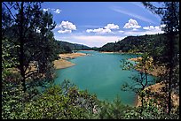
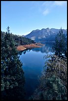
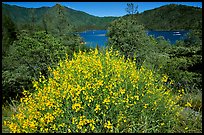
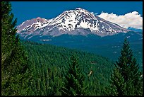
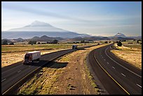
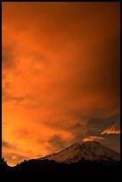
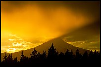
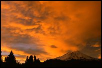
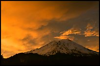
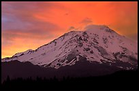
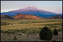
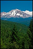
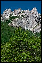
North of Shasta Lake, a reservoir with multiple arms, between the small towns of Dunsmuir and Yreka, the landscape is dominated by Mt Shasta, at 14,179 ft (4,322 m), the second highest point in California. Mount Shasta, the centerpiece of several faiths and cults, is a dormant volcano that rises abruptly 10,000 ft (3,000 m) above the surrounding area and can be seen more than 60 miles away.

[CLICK on any picture to see a larger image and details, to add to selection, to order, and to download wallpaper.]

Cantilever spar cable-stayed Sundial Bridge, Redding. California, USA ( color) Looking up through opening, Sundial Bridge, Redding. California, USA ( color) Shasta Lake, Wiskeytown-Shasta-Trinity National Recreation Area. California, USA ( color) Shasta Unit,  Wiskeytown Shasta Trinity NRA. California, USA ( color) Deck and boats, Shata Lake. California, USA ( color) Deck with family preparing a boat, Shasta Lake. California, USA ( color) Clear Sacramento River, Castle Crags State Park. California, USA ( color) Castle Crags, Castle Crags SP. California, USA ( color) Home of the best water on earth mural, Dunsmuir. California, USA ( color) Old car in town center, Dunsmuir. California, USA ( color) Historic buildings, Yreka. California, USA ( color) Old Town, Yreka. California, USA ( color) Bush in bloom with yellow flowers, and Shasta Lake criscrossed by watercrafts. California, USA ( color) Kayakers on the rapids of the Trinity River, Shasta Trinity National Forest. California, USA ( color) Forested slopes and Mount Shasta. California, USA ( color) Mountaineers on the slopes of Mt Shasta. California, USA ( color) Climbers on the Green Ridge of Mount Shasta. California, USA ( color) Mountaineers on the summit of Mt Shasta. California, USA ( color) Highway 5 and Mount Shasta. California, USA ( color) Clouds dramatically colored at sunset above Mt Shasta. California, USA ( color) Last sun rays over  Mount Shasta. California, USA ( color) Spar and cables, Sundial Bridge, Redding. California, USA ( color) Clouds over Mt Shasta at sunset. California, USA ( color) Fiery sky over Mount Shasta at sunset. California, USA ( color) Sunset and clouds above Mt Shasta. California, USA ( color) Mount Shasta in late summer. California, USA ( color) Mount Shasta with climbers on Green Ridge. California, USA ( color) Climber takes a break on the Green Ridge of Mt Shasta. California, USA ( color) Mountaineers camping on the slopes of Mt Shasta. California, USA ( color) Barn and hay, Yreka. California, USA ( color) Old town main street, Yreka. California, USA ( color) Main Street, Yreka. California, USA ( color) Mount Shasta seen from Castle Crags State Park. California, USA ( color) Limestone cliffs, Castle Crags State Park. California, USA ( color) California Theater facade detail, Dunsmuir. California, USA ( color) Main street, Dunsmuir. California, USA ( color) Reflections in store window, Dunsmuir. California, USA ( color) Family on the shore of Shasta Lake. California, USA ( color) Boats in marina, Shasta Lake. California, USA ( color) Red earth around an arm of Shasta Lake. California, USA ( color)
All the 40 color pictures of Redding to Yreka are on this page